Mapping the World: Perspectives from Asian Cartography is a small temporary exhibition in the Singapore National Library. It showcases rare historical maps with a focus on Asian regions covering those in South and Eastern Asia. Also, the exhibition touts to bring together different mapping traditions across cultures, religions and regions covering worldviews, political and cultural spheres of influence. Let’s see what’s on with a gallery walk through.
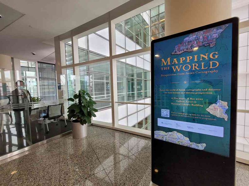
Following COVID-19 suspension of exhibition events at the library, exhibition areas have re-opened with enhanced safety measures. The mapping exhibition gallery sits in the building’s 10th floor of the National Library Building in the Bugis district. Also, you might remember the spot being the exhibition spot for the Human X Human and Malay Manuscripts exhibition we visited previously.
Early maps in various forms
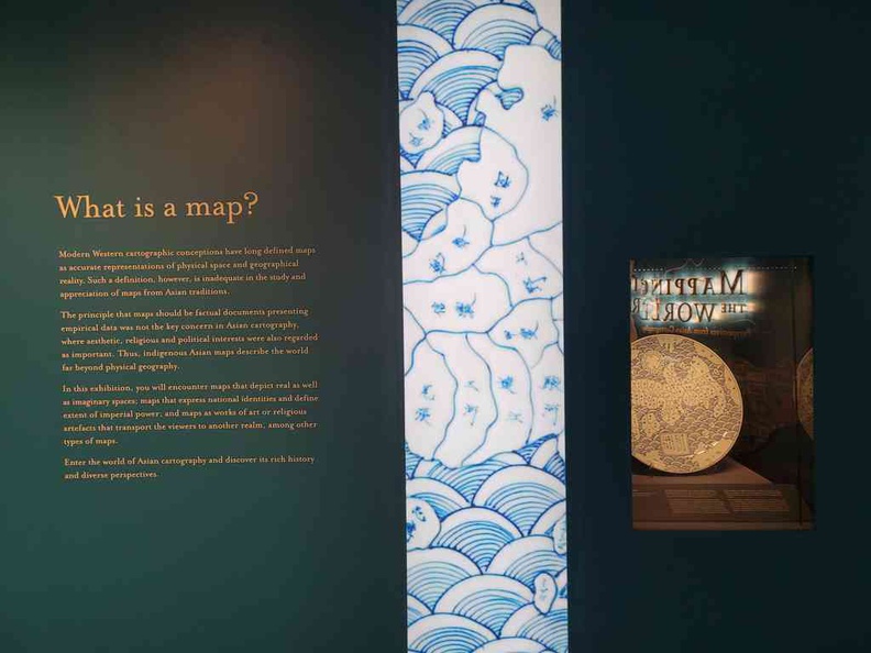
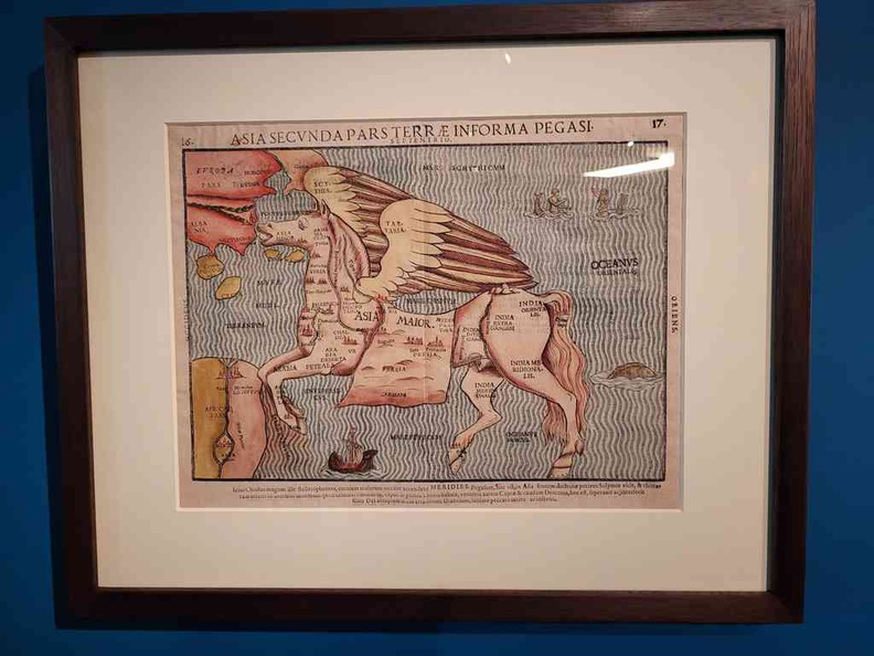
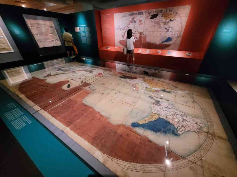
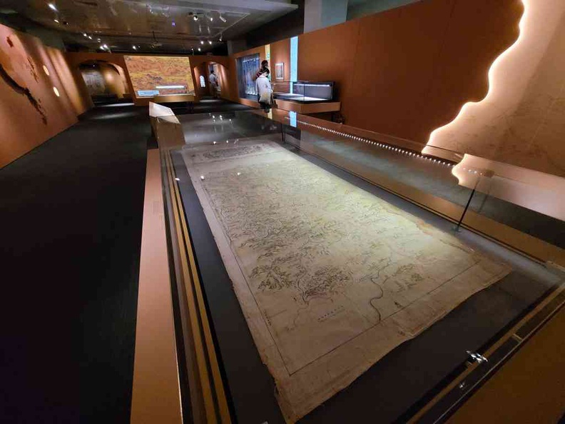
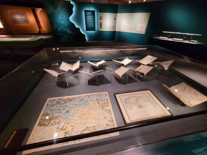
Furthermore, in a nutshell, the gallery exhibition comprises of an assortment of historical maps in displays or hung from walls. Moreover, the exhibition opens up and illuminating window into how fascinating civilisations see themselves and the world across time and space. Also, interestingly, the maps on display ranges from city maps, regions, graves, to entire countries and continents.
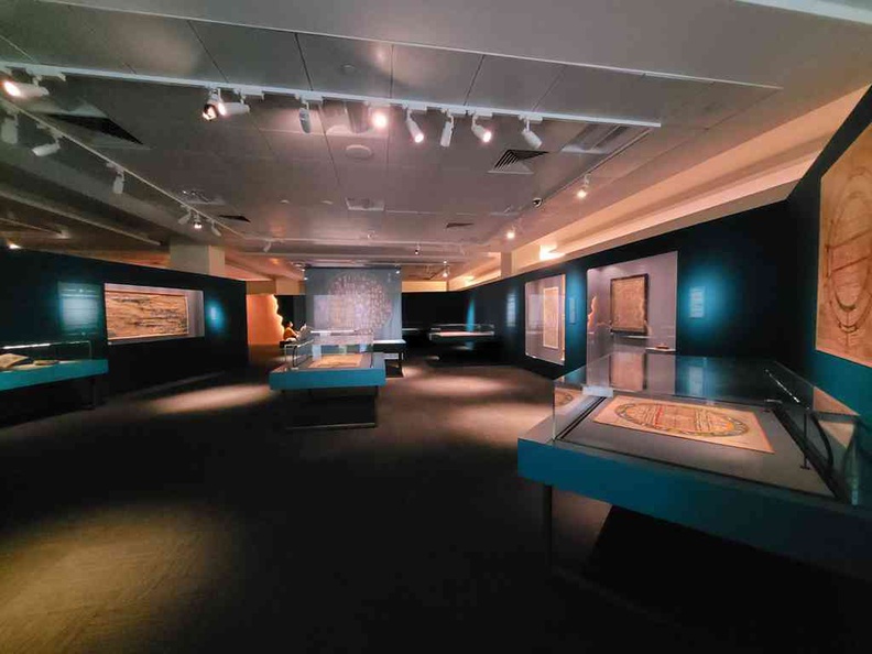
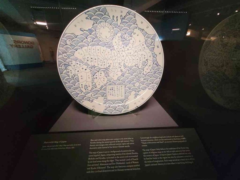
Here, the various maps are painted on non-traditional mediums during its era. Examples includes pottery and plates. Also, some are even imprinted or interwoven onto large canvases. Additionally, you can find a number of Chinese and Japanese maps on plates here.
Map Highlights
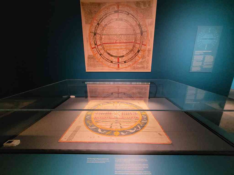
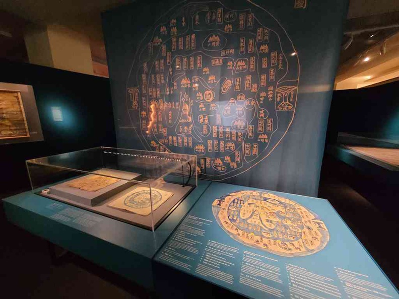
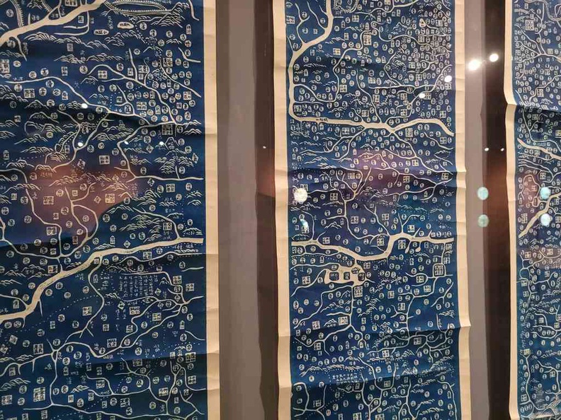
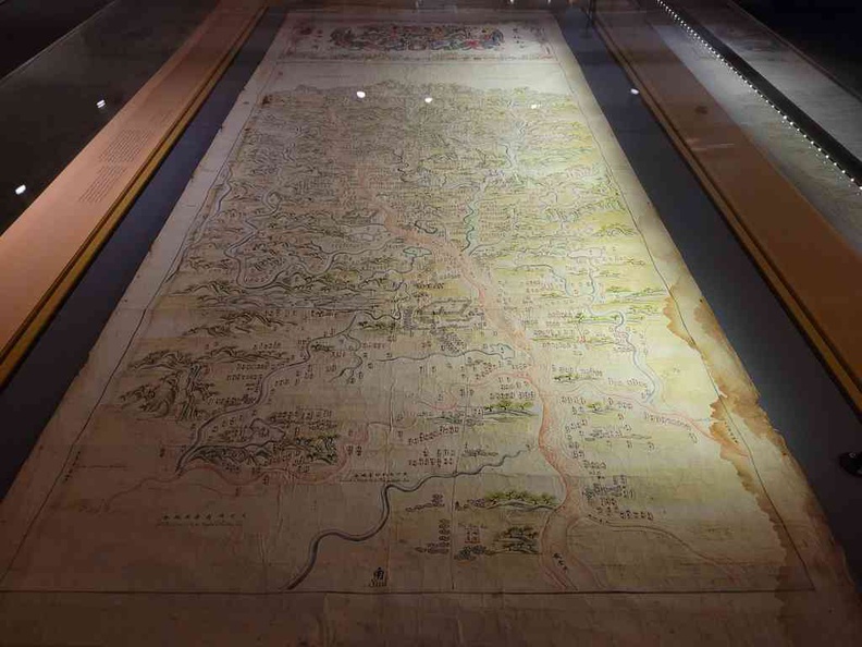
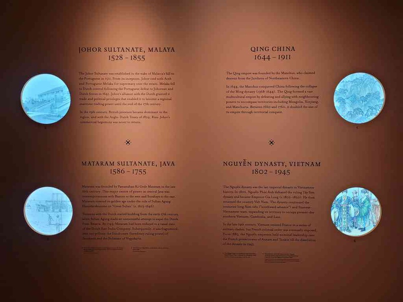
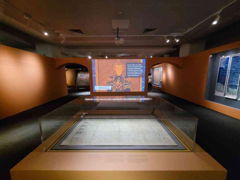
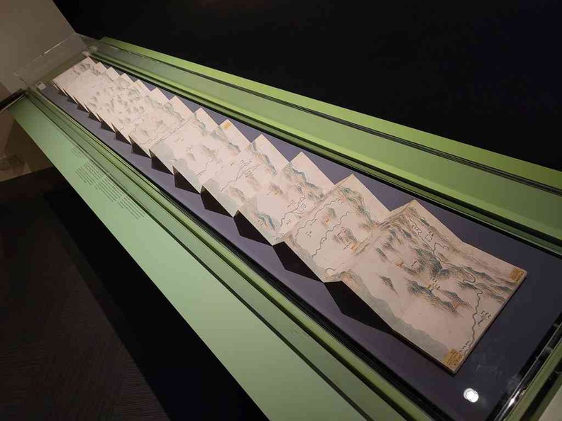
Moreover, small maps are aided by large infographics, with blown up image reproductions of the original map to allow you to have a closer look at the drawings with annotations. Interesting ones includes a maps of the Qing dynasty.
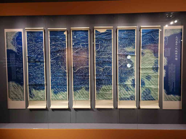
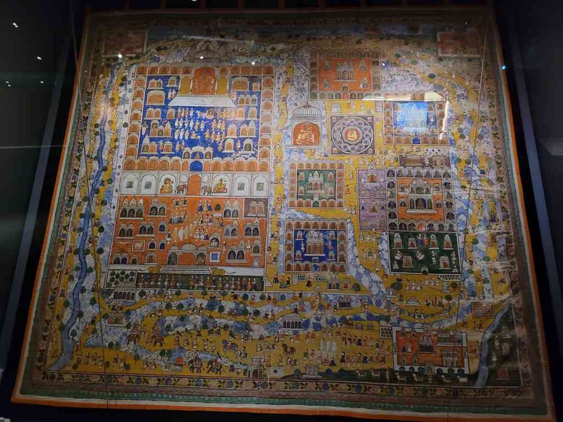
In addition, it is done on 8 separate vertical hanging drapes. Also, there is a grave site map. It is drawn on an accordion style card which folds into a book when closed up. Another highlight is an Indian tapestry, depicting the location of several buildings in the city town of Shatrunjaya India.
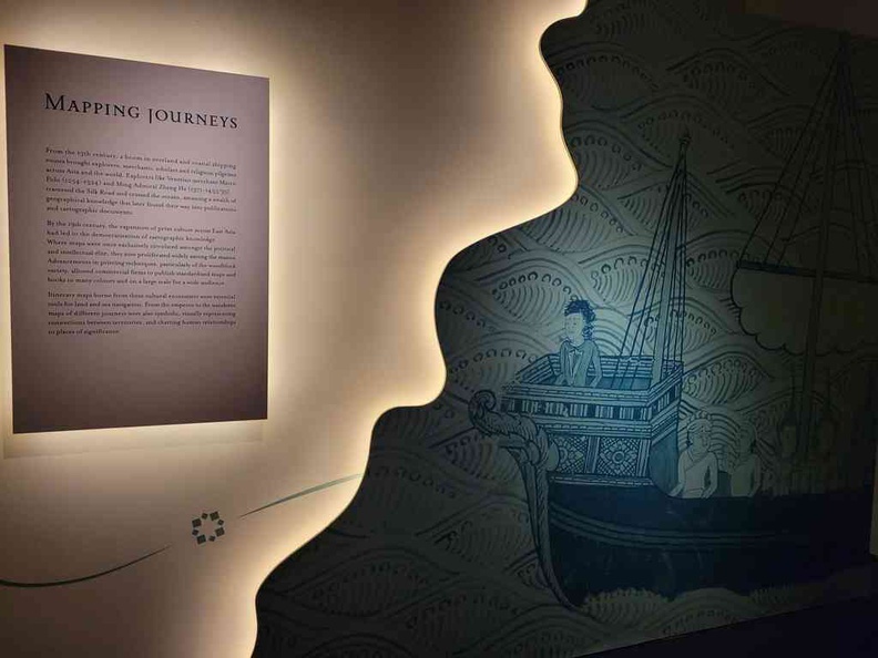
Additionally, through evolution of print media, the gallery shows the gradual improvements of map drawing as more areas are explored by foot or sea. Moreover, on display as several navigator maps and techniques, particular astro-navigation. Also, it could helped in determining distances and sizes of land masses which allows for greater refinement and accuracy in producing these maps.
A global curation
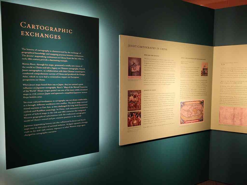
Furthermore, the exhibition sees in partnership with the Embassy of France in Singapore provision of items provided from overseas institutions and private collections from France. Also, examples include those from the Bibliothèque nationale de France, Musée Guimet and École Française D’Extreme-Orient in France.
Also, the exhibition highlights rare maps from the National Library collection in Singapore, as well as local institutions such as the Asian Civilisations Museum and the Indian Heritage Centre. Also, other notable map contributors includes the United States MacLean Collection, in Illinois, and those from Japan Yokohama City University.
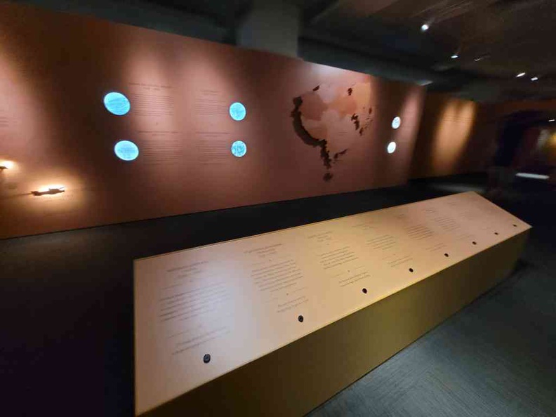
Moreover, the galleries are open and sparse which makes navigation easy and straightforward. The galleries also follow through in a one-way route with distinct entry and exit doors.
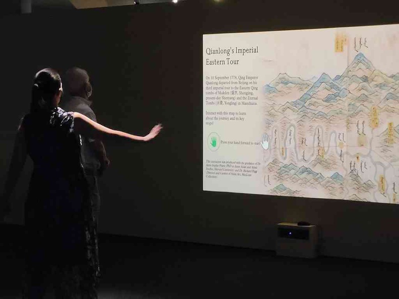
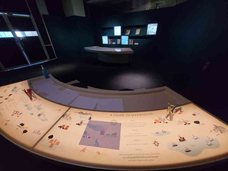
Some interactive displays
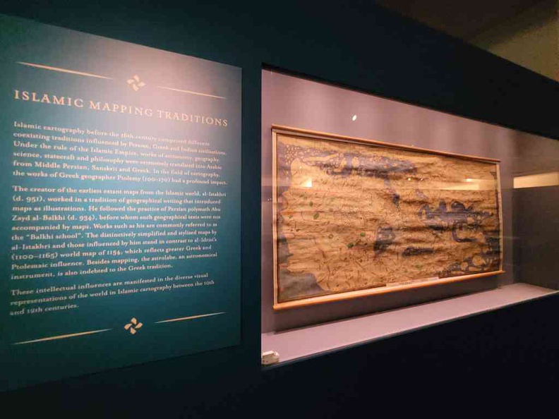
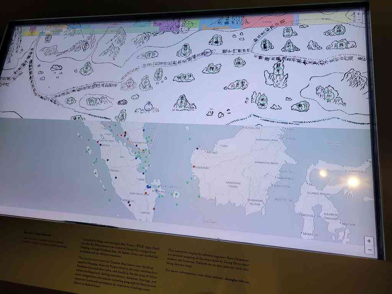
In addition, the galleries are generally dimly lit. Also, the maps sealed and kept behind climate controlled cases and away from direct sunlight. It is to protect and preserve the ancient maps from degradation. Additionally, there are a couple of small interactive displays such as “light it up” board which responds via a button board. Also, you can also find a couple of interactive screens as well as a motion capture screen allowing you to navigate and view more maps.
However, I found the galleries rather sparse, as compared to the other exhibition we visited here. It could probably be due to the lower numbers of exhibits on display to fill the space.
Furthermore, at the last gallery, like with every National library exhibition, the tour ends with a section of curated books on the topic of maps for the curious to read on and understand further.
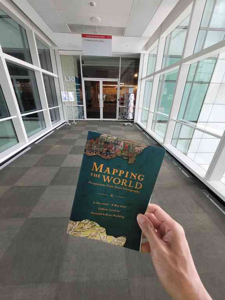
All in all, you are good for Mapping the World: Perspectives from Asian Cartography for about an hour tops. It showcases the exchange of cartographic knowledge between civilisations across the world. Also, the exhibition runs for a period of 6 months from 11 December 2021 to 8 May 2022. The galleries are opened daily 10am to 9pm.