The twin peaks (also known as the San Francisco hills) are two high hills standing at an elevation of 281m at the geographic center of San Francisco itself. They are the the second-highest point in San Francisco, after Mount Davidson and is part of the iconic 49-Mile Scenic Drive in San Francisco, with one of the highlights being the views up from the Crestline Drive. The fastest way to the starting base of the twin peaks is from downtown, taking the F-line historical trolleys west-bound for about 20minutes before alighting at the Castro district.
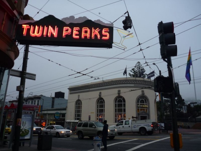
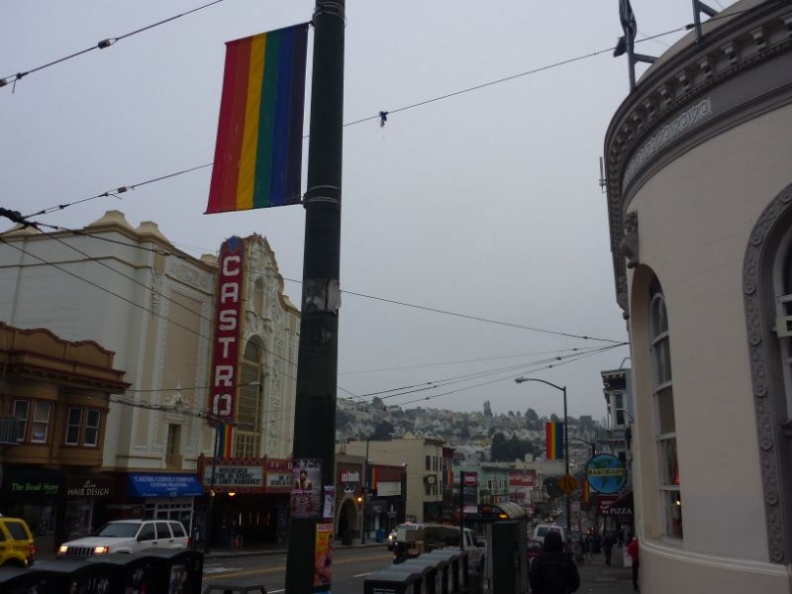
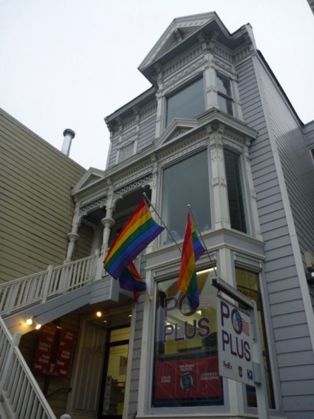
The Castro district is located by the foot of the twin peaks and the Eureka Valley of San Francisco. It is also the city’s Gay district and is one of America’s first, largest and best-known gay neighborhoods in the world. The place is a Gay melting pot, with a strong LGBT presence, with rainbow pride flags decked on nearly every home and corner of the street. The district’s main bus and trolley stop by the junction is also home to the world’s largest rainbow flag.
The locals here say that the town here is the symbol and source of lesbian, gay, bisexual, and transgender (LGBT) activism, going with the American’s dream of free rights and equality for all regardless of gender and orientation. Iconic LGBT events of the capital are held here too. It is indeed a very diverse and yet surprisingly friendly district of the city which you can never see in conservative Asian countries.
From here, there are two main ways to get up to the twin peaks, one is by the Muni 37 Corbett bus service which takes you up from the Castro main stop, right up to the Crestline Drive or you can climb up to the hill yourself. Personally I would recommend climbing up on the first go and taking a bus down back to town thereafter. After all, you can’t say you’ve conquered the Twin Peaks if you’ve never scaled it yourself. That and the bragging rights will definitely make you appreciate the views from the top better too.
Guide up the Twin Peaks
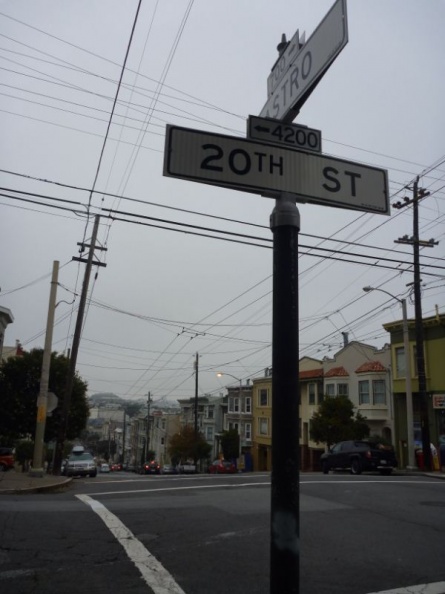
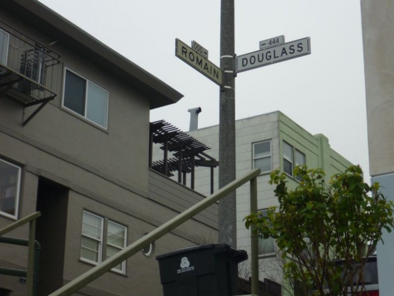
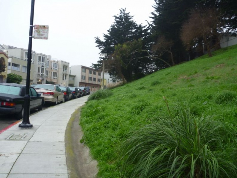
The climb up is not that taxing either, and will take about 20-30 minutes depending on your fitness. It’s a fairly straightforward climb through the neighborhood residential areas. I will touch on a small guide on how to get up there on foot, or driving from Castro, with few key intersections to note too. First, start off south bound along Castro Street, you will pass through the commercial area of the district before migrating to a more residential area. Keep going for about 3 streets before hitting the intersection to 20th Street, thereafter head west bound for 2 blocks along Douglass Street before turning left, here you will cut through the intersection of Grand view avenue, which you can use as a location marker
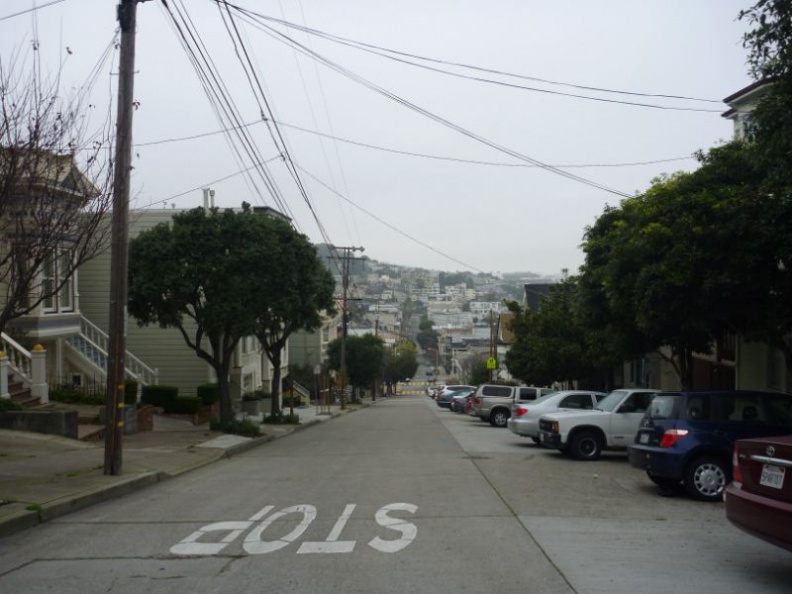
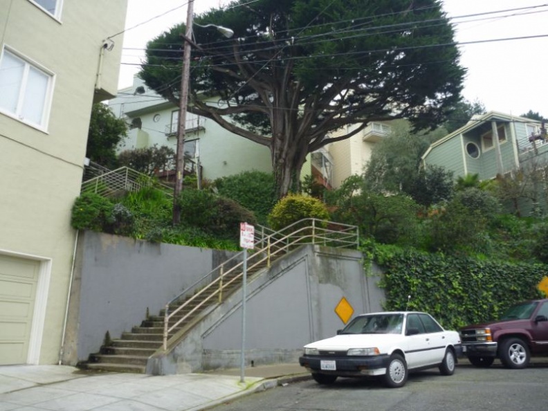
It on this hills where you can also get to appreciate the steep slopes which San Francisco is notorious for, but it’s these hills themselves which gave rise to the iconic stepped terrace houses which we are all familiar with in shows and movies alike. It also pays and interesting note to all the cars parked here too, turning your car steering wheel into the direction of the kerb while parked on the hills is a standard practice here, let be a life saving one too.
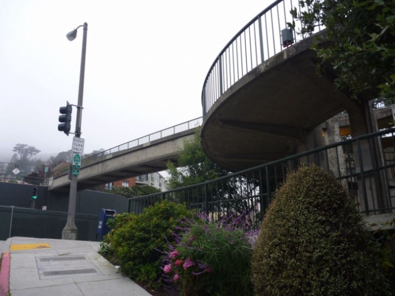
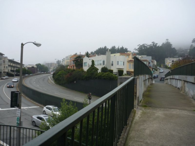
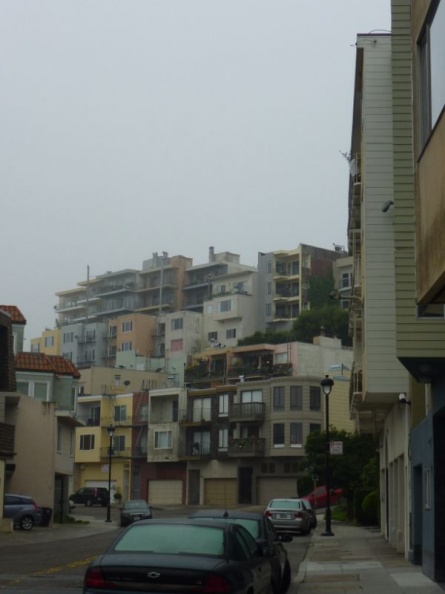
It will be not long where you will reach a busy intersection. This road is Market street, crossing the overhead pedestrian bridge here will bring you on a relatively straight flat road along Cornett avenue before hitting the foothill entrance to the Rooftop Elementary School.
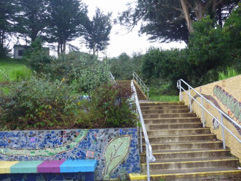
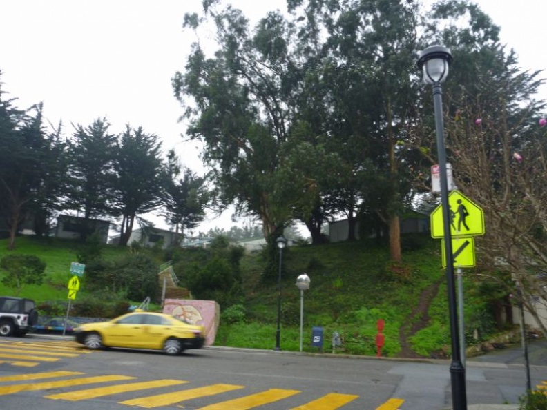
Do not climb the stairs with the fancy tiled mosaic entrance, as this brings you right into the school compound itself, with no through road. Instead, make your way left along the foot of the small hill which the school is on, along Burnett avenue, you will pass by many taller residential houses here.
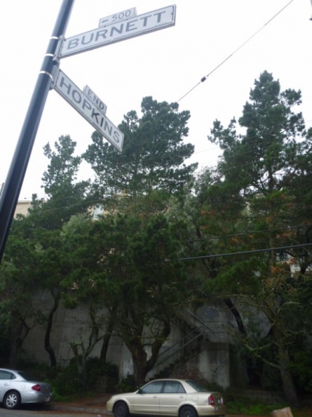
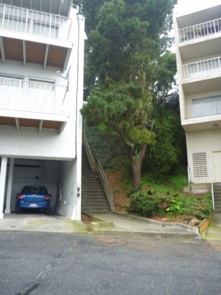
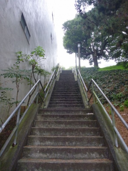
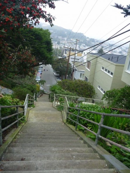
Make a right towards Hopkins avenues after about 100 meters, thereafter you will come across several staircases along the road side, going up two of these long flights of stairs will bring you along Vista Lane and finally up onto the Crestline drive, which is the highest residential drive on the hill. The Crestline drive is also where you will catch your sub 30 minutes to hourly bus back down to Castro, tickets cost $2 for ride regardless where you are alighting.
In a nutshell, the route from Castro to the Twin Peaks summit is as follows in the map I’ve compiled on my trip below:
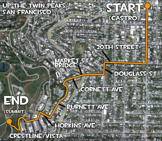
Hope this map (oriented north upwards) will prove useful for anyone intending to head up to the twin peaks themselves. Now lets finish the climb up to the summit!
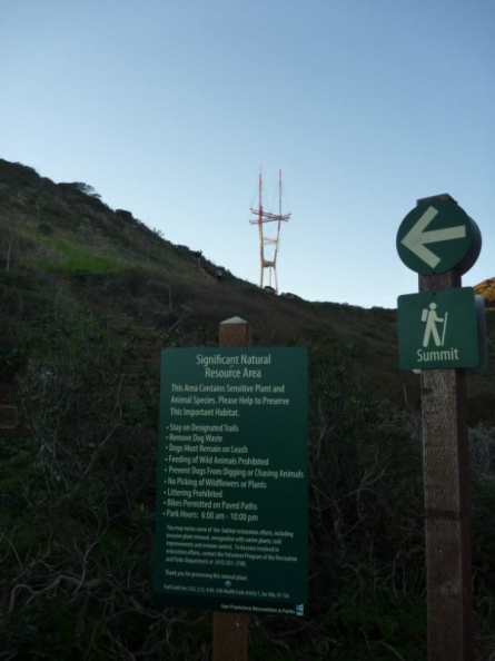
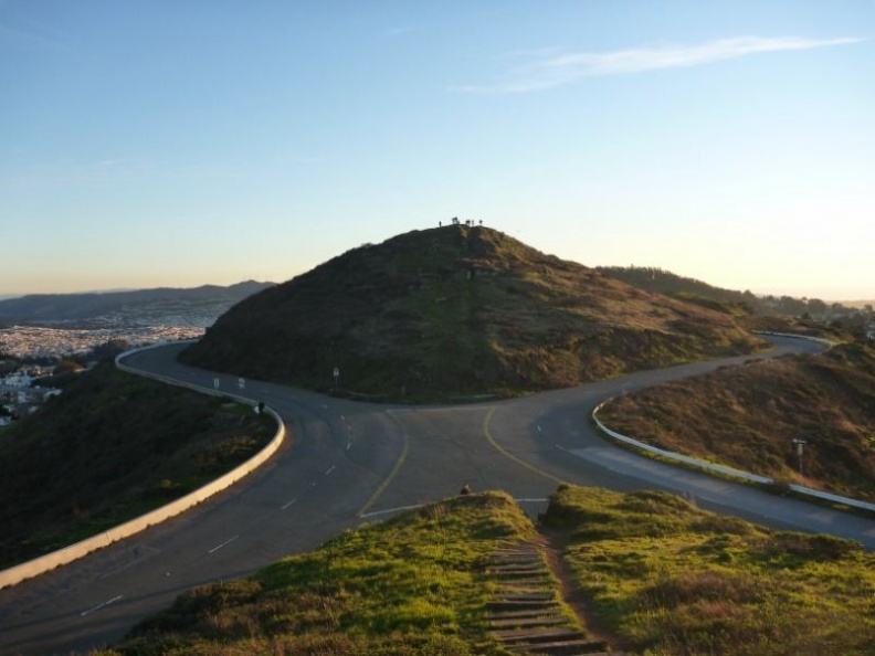
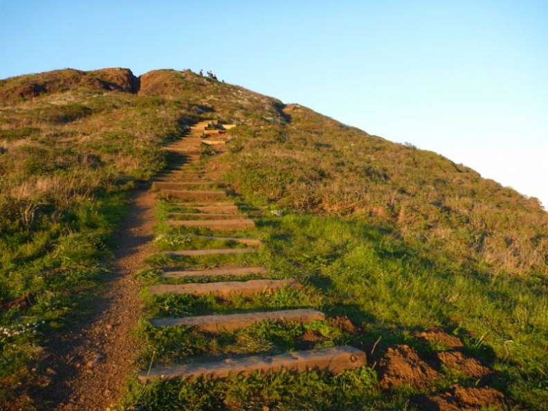
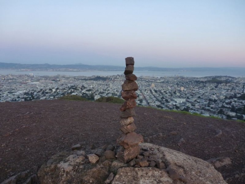
The top of the hill is largely undeveloped and access to the summit is served by dirt trails and steps leading up to the top. Up here, you can grasp the vastness of the summit area, well served by the Twin peaks boulevard, which are the circling “figure of 8” looping roads as pictured.
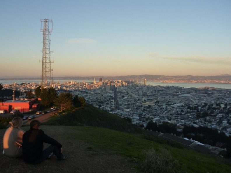
The best time to be on the twin peaks, as a general rule of thumb when I visit most scenic spots, is just before sunset, so it’s good to ration out over and hour at Castro for the climb and photo taking on the summit before the sun starts setting. The eastern views from the summit offers a breathtaking view of the city of San Francisco, with the ionic Transamerica pyramid, the golden gate bridge and the bay bridge visible in the distance too. You can also catch the San Francisco bay, with it’s shipping routes along side the bay, the mountainous backdrop across forming up the horizon of the view.
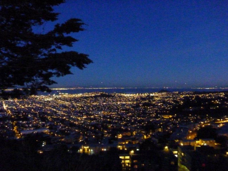
The summit of Twin Peaks remain mostly undeveloped yet unobstructed views of most San Francisco and the San Francisco Bay. As the sun sets, you can watch the shadow of the peaks slowly rushing over the eastern side of the city like a wave, it’s not long after where the whole city is blanketed by the shadow of the peaks themselves.
San Francisco City on the eastern side:
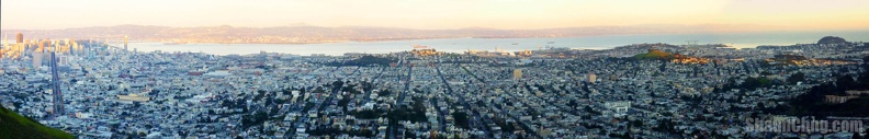
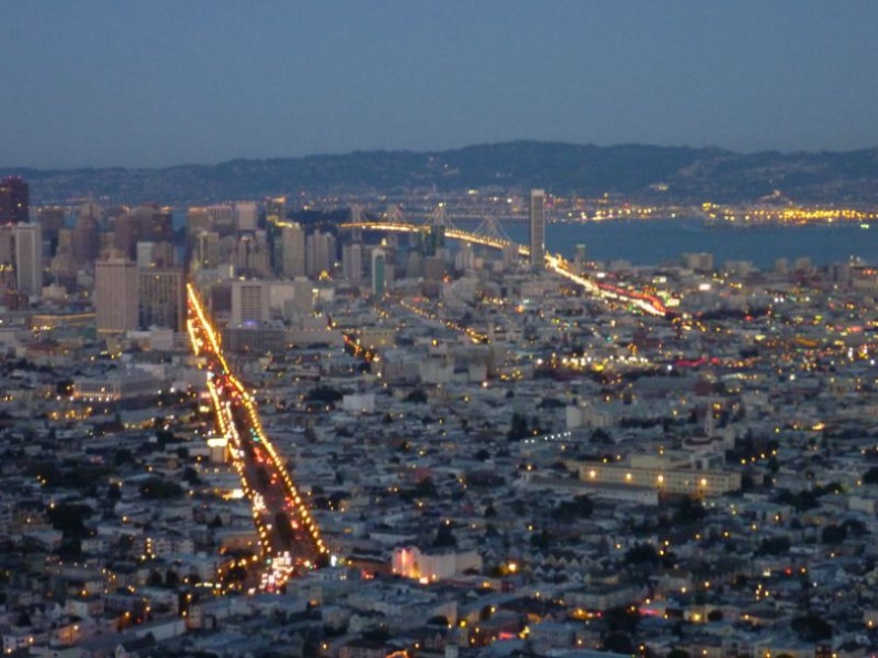
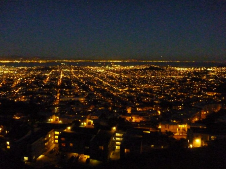
Soon after the whole city will by transformed into a sea of golden lights at night, with the bay bridge and the golden gate brighly lit on the distance on both extreme left and the right of the city view.
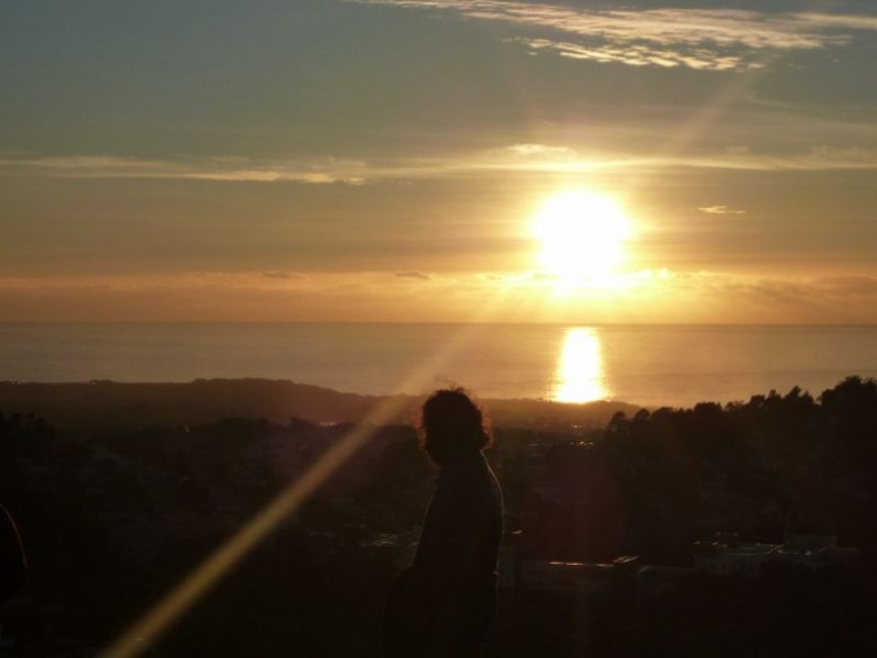
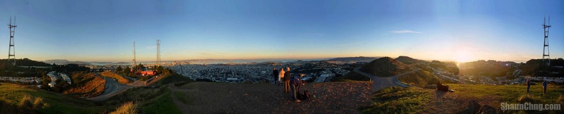
360 degree view off western side of the peaks, overlooking the sunset:
The best way to catch the city and western horizon of the pacific ocean is from the top of the peaks themselves. There is a sub viewing station at the bottom of the northern peak with telescopes and toilet facilities. The twin peaks is also home to the iconic Sutro tower, which sits squarely north of the twin peaks. It is a radio tower and one of the most visible landmark from anywhere in the city of San Francisco. The top of the hill is also home to the city’s many reservoirs and is owned by the San Francisco Fire Department, and supplies water to the Fire Department’s independent HPFS water system for fighting fires. This system was established after the 1906 Earthquake and Fire which razed much of the city then.
Do note that it can sometimes get very foggy up on the twin peaks, going up on a such a day will end up seeing nothing but a sea of white. It is also generally advisable to avoid going up in the mornings. I will strongly recommend to check the weather forecast for fog on your intended day of ascent as foggy weather is surprisingly very common here in the bay area, this also applies for most scenic sights on the bay area too so it pays to do your homework beforehand to avoid any disappointment. A good quick and simple gauge is to get a good look of the Sutro tower on top of the hill from anywhere in the city, if you can clearly see the tower, then it will look the same from the top down- a good day for an ascent.
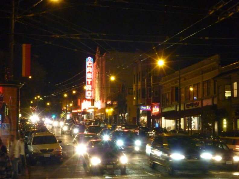
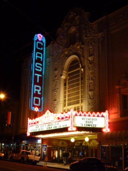
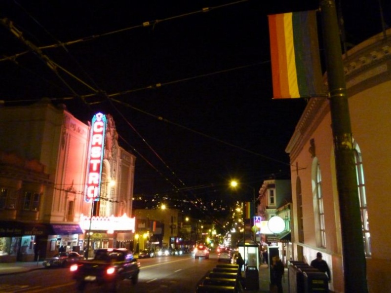
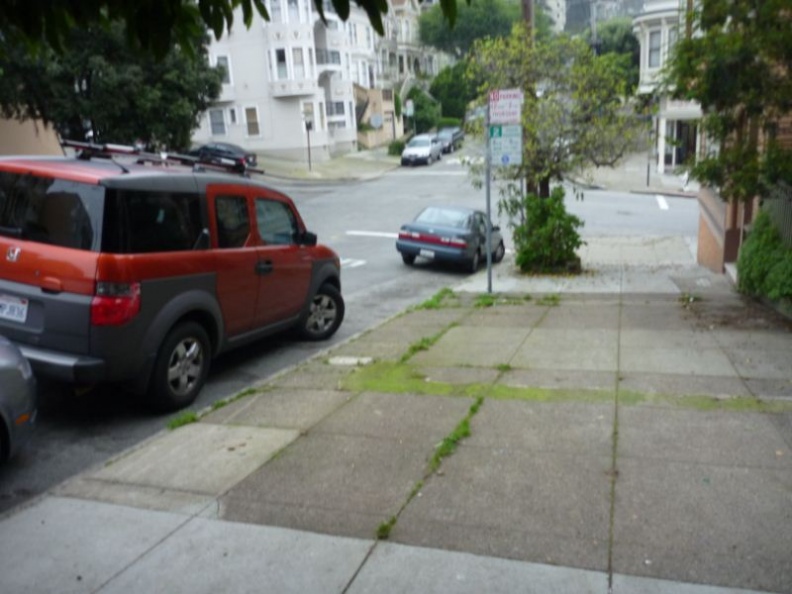
As said, you can head back down the twin peaks from where you came from or catch the sub-hourly bus service 37 back to Castro where you can connect to the F-line trolley or the underground BART there. The district of Castro is nicely lit and is a rather busy place at night too. There are a number of pubs, bars as well as retails outlets selling clothing. Notable landmarks here will include the iconic Castro theater with their rather interestingly humorous titles to the shows they are currently screening.
Ok, that’s all for the twin peaks for now. Cheers!
- Chilling out in the city of San Francisco (Pier 39, Fisherman’s Wharf) (Photos: City Album)
- San Francisco Cable Car Museum, Palace of fine arts and Exploratorium
- Up the Twin peaks and the Castro district, San Francisco (Photos: Twin Peaks & Castro)
- Golden Gate Bridge and Fort Point (Photos: Golden Gate Bayside)
- Golden Gate Park and Deyoung Museum (Photos: Golden Gate Park & De Young)
- Legion of Honor Museum (Photos: Legion of Honor Album)
- On the Alcatraz (The Rock) (Photos: Alcatraz Album)