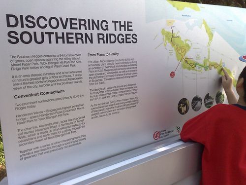
The southern park ridges is part of the newly constructed park connectors which aims to completely link all the various parks in Singapore in a continuous round island loop, taking you from ends such as Choa Chu Kang to Changi coast road.
This southern portion of the island loop (also known as the Southern ridges) spans a total distance of 9km from Mt Faber via Harbour Front and ending at West Coast Park, well that is so as claimed by the May 11th 2008 Straits Times article and takes about 3-5 hours to complete. However, with so much publicity how interlinked these routes are realistically, such routes are actually and awkward attempt to link various segmented and nucleated parks, often with not so seemlessly- runners have to cross major roads, bridges, highways, etc to get from one park to another not only posting a safety hazard to runners but do not offer much of the integrated and inter-connected feel. So is this park connector 9km route comparable to that of dedicated running route or simply just a claim? well lets find out.
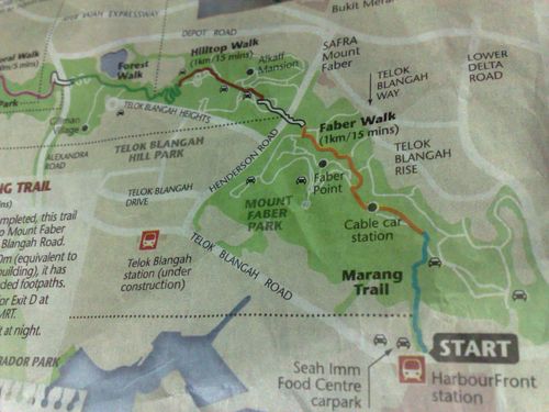
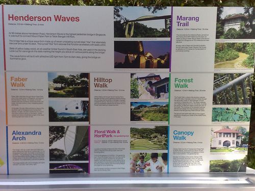
The whole 9km route will see you from Harbour Front MRT- Mount Faber Hill- Henderson Waves- Telok Blangah Hill- Alexandra Arch- Hortpark- Kent Ridge- Clementi Woods and finally, West Coast Park, you can do the route in reverse, but I will be covering this review from Harbour Front itself. You can view the full photo walkthrough of the walk in it’s own photo gallery here (156 images).
First hard climb, smooth sailing thereafter
There are actually quite an assortment of roads leading up to Mt Faber, whether you are on a vehicle or walking up. But most of the stair routes are either closed or re-routed to another newly paved route. I have old memories exploring the hill side when young, but that was before the place took the massive revamp- much of those old paths are blocked by fallen trees or all overgrown in vegetation now, there are though there are some old passable routes upnear Al-Amin mosque or Shelton college international along Telok Blangah Rise.

Now there a namely only 2-3 main ways up the hill now, either the old conventional road way or the new Marang Trail.

The Marang Trail
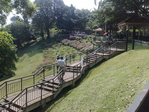
Not too far from Harbour Front MRT station is the public carpark beside the Seah Imm food center. Beyond the carpark is the start of the Marang trail (named after the small slip road called “Marang road” just off Telok Blangah road. The route starts from the base of Mt Faber which takes a descent but quick 10-15mins climb up gravel and wooden staircases right up to Mt Faber. Alternatively you can take the old conventional, but longer road way up the hill roads from the Faber lodge area (Mt Faber Road). Either way, both areas are pedestrian and runner friendly with a setback for each- you will encounter quite alot of steep uphill steps on the Marang trial which is a big no-no for cyclists, but the air is relatively fresher and shaded than the road route.
Mount Faber hill
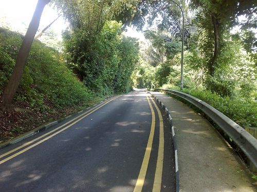
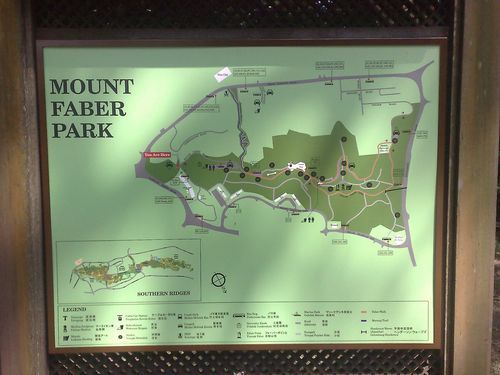
The old road way up is more inclined towards hill work runners and cyclists, but you get quite alot of vehicles passing by which can not only be dangerous but makes you having to put up with the occasional blast of exhaust fumes from the cars and tour buses climbing up. There are also the other existing stair routes/treks up to Faber Point as well (such as the route from Safra Mt Faber and Telok Blangah market etc) all being upgraded as well. You will be greeted by the park map at the top where are able to get your directions and orientations from there.
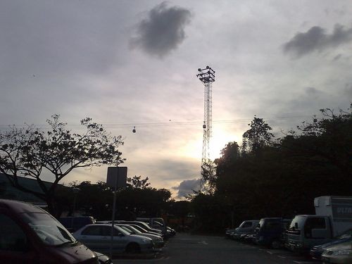
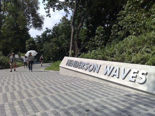
A walk through the covered Faber walk along side the roads will bring you pass few prominent landmarks of Faber hill, such as the 2 communication towers as well as the Jewel box (aka cable care station). It will be quite a fool-proof walk through the tourist-laden walkways offering few rather good views of the surrounding Telok Blangah residences, Keppel port as well as the distant view of the central business district, it will be not long before finding yourself past round the Faber loop towards the first highlight of our trek- The Henderson waves.
Henderson Waves bridge
The southern park connector prides itself as being Singapore’s only integrated “high attitude” park ridge walk. With the Henderson Waves bridge taking the honor as Singapore’s tallest “over head bridge” or pedestrian bridge if you correctly address it. The bridge spans the top most peaks of Mt Faber and Telok Blangah hill and peaks at a maximum height of about 77.18m above sealevel based on the various labeled markers lined on the bridge decks.
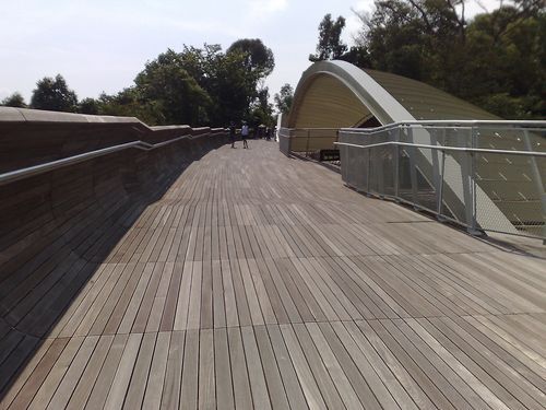
Where most engineers will usually not disclose the array of complex scientific equations involved in designing a bridge, the wave bridge on the other hand flaunts them with it’s distinct sinusoidal waveform design, which theoretically have not only function in keeping the bridge rigid over it’s entire span but giving the bridge it’s curvy and distinctive wave look, hence the rather generic name, Henderson Waves.
The bridge have wooden timber floor panels lined all along the whole span and going all up the guardrails as well, where they are all seated and bolted on the contorted exposed main glider steel structure, which waves in and out from the bridge deck, protruding in and out at regular intervals above the walking deck.
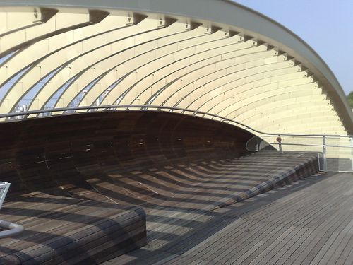
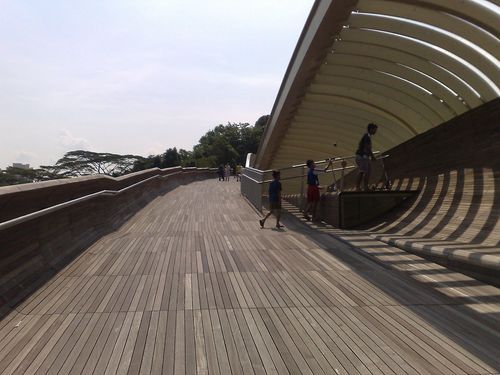
The part of the super structure which sticks above deck serves as partial sun shades, which did quite a good job in partially blocking out sunlight on the sunny day of my visit. The open shelter-less concept makes the bridge very airy as well, so staying there for prolonged period is largely bearable in the sun as well- there were even few families having a picnic in few of these resting areas, which goes to show the effectiveness of the shade, though all these are useless in the event of a downpour.
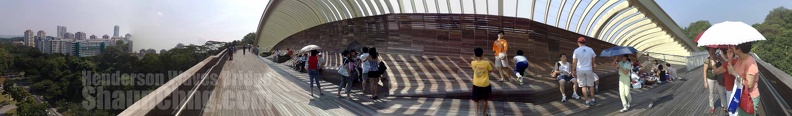
Henderson waves bridge 180 degree view from the bridge at midspan.
There is no rule forbidding bicycles and skate scooters on the bridge, though it will generally be recommend for riders to dismount and push for the whole span given the rather narrow confines on the bridge deck itself- also so you won’t be much of a nuisance (to our rather complaint-tive people), as well as allowing you to appreciate the views from the bridge itself.
I’ve received quite a number of feedback from our physically challenged friends alike who visited the place. A point to note when crossing the Henderson Waves bridge is the incline the bridge has from Mt Faber up towards Telok Blangah Hill- it can get rather tiresome to cross the whole span as it is a continuous incline from end-to-end. A suggestion is to start from Telok Blangah hill (and park at the free carpark there) and go downwards towards Mt Faber.
On top of that we had been in contact with the NEA in installing “stoppers” or railings at certain intervals of the bridge as a safety measure so that there will be no runaway wheelchairs or baby strollers if one were to start rolling on the bridge itself.
Nevertheless, most part of the route leading to Hortpark from Mt Faber is wheelchair accessible with the exception of few road kerbs.
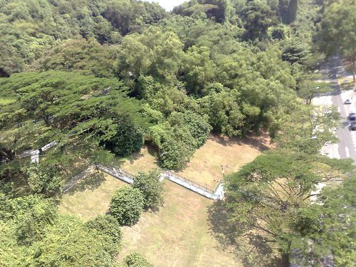
Across the bridge is Telok Blangah Hill’s mini forest walk which is a short mini connector path to the hill top carpark which can be accessed from Henderson road itself towards the all familiar Alkaff Mansion landmark, which sadly too also lies in the shadows of it’s past given the array of family-friendly facilities littered all around the hill, such as multipurpose event areas and children playgrounds.
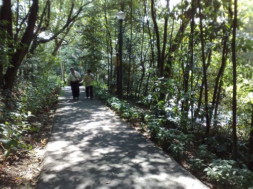
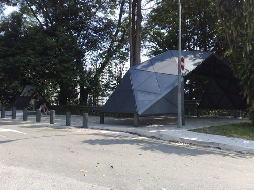
Following the road further on Telok Blangah Hill into the Telok Blangah Hill Park (along Telok Blangah green) past Alkaff Mansion will bring you to the Terrace gardens. We won’t be visiting the Terrace gardens for now as it’s not part of the connector, so we will be giving this one a miss. Taking the loop out of the gardens and moving on North-west will bring you along more winding hillside roads before meeting your next highlight of the walk- the Forest Walk as well as the Alexandra Arch which lies beyond it.
(You are currently viewing page 1/3)
- Page 1/3 » Henderson wave, Arch, Hortpark, Canopy walk
- Page 2/3 » Forest walk, The Alexandra Arch & Hyderabad Road’s Hort Park
- Page 3/3 » Canopy Walk, Kent Ridge Trail, Clementi Woods & West Coast Park
:: Southern Ridges Full Photo Gallery :: Running Route Article Index Page ::
wanted to go there if I have the chance! But I am so busy recently!
lol, considering that you actually reside nearer there than me!
I will conclude the article by friday, so it you want a gist of it, the area from Mt faber to Hortpark are the only good area of the route. The very most you should go to (or from) will be Kent Ridge Park where theres free parking.
hi,
i would like to ask about the Henderson wave. It seems really a nice place.
how do you get to the Henderson wave?
its it near Mt Faber and within walking distance?
Thanks!
Hi Willy, the Henderson waves stands in between Mt faber and Telok Blangah hill, so technically you have to get up on end these both ends to get on the bridge!
If you wish to catch a view of it below, the nearest landmark to head to will be Safra Mt Faber, where you can follow down the main road for the bridge. There are stairs there for you to make your way up to the hill and eventually on the bridge.
The most convenient option for most commuting there will be to alight at Harbor front MRT and take the marang trail up to Faber hill.
If you are driving, you can choose to drive up Mt faber or Telok Blangah and park at the public carparks there. Parking is free.
hi,
I would like to ask for more info about this southern ridges. Is it possible to have a common starting and ending point. I would be organizing a walk for my coy so i would like to plan the route well. Hope you are able to help. Thanks
hi icybb, mmm a common point, that will be rather difficult as the route itself is not a continuous looping circuit but rather a long linear route.
So there will a point where you will have to walk back from where you came from. Usually what I will recommend is to start from Telok Blangah (TB) hill, then from there you are in between the Henderson waves and the Forest walk, which ever direction you start you can always return to the center.
From the TB hill there you can check out the waves first, then U-turn and head towards the forest walk -> hortpark before catching transport (or meeting) from the main road at Alexandra road.
Hi Shaun,
Pls help.
am organising a coy event to Henderson waves. pls advise which best route to start from Harbourfront then still end at Harbourfront ? distance & timing ?Any open space along the way for a game session for 20 people ?
hi csc, for games and events, I will recommend the top of telok balanga hill, near the carpark and the toilets, there are few open spaces and playground for games for a small group of 20, otherwise you can try the Terrace walk (the white stairy area) as well.
Mt faber hill is the other option, but that area tend to be packed with tourist and people moving around, it’s not as quiet as telok balanga hill.
Hi Shuan,
Is there any route for me to have a morning jog around 45 min if i am working at Alexandra Technopark?
I come to work early so thought of going for a jog everyday before starting my day..
Thanks
Hi Dolph, from the technopark, I suggest that you can try running from Alexandra road towards depot road (you will need to cross a junction there), the air is great and fresh in the morning. It will be alittle hillwork up along depot road, where you can stop by the food center for breakfast if do as well.
I won’t recommend the arch-> forest walk unless you like pounding on metal grates in the morning, otherwise the forest walk is a good place to run as well with minimal steps as well.
I believe you do your runs early in the morning? Otherwise I can recommend running within Hortpark as well, but it should not be opened then.
i was wondering if this is telok blanga old college coz im still researching for tat place????any idea
Hi ain, I am not sure of this telok balanga old college. Is it an address of a center within another building of a different name itself? There are quite a few dysfunct school compounds in the area though, maybe you could be are looking for a place which do not now.
Thanks for the blog and pics, I am thinking of going there for jogging, did you see anyone run on it ? Thanks!!
Dear Shaun
I enjoyed reading your blog post. As you are familiar with the Mount Faber area, I wonder if you could please shed some light on the location of the old brick tower featured in this episode of Site and Sound hosted by Julian Davison and shown on TV around 2004. The tower is shown from 12:45 onwarads. Best regards. Leslie
https://youtu.be/O5GzmD6lerQ
[…] the name, Handle bar “Original”. This hipster and art gallery. It is situated by the Singapore southern ridges forest walk and Hort […]