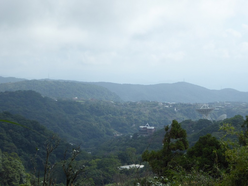
Yang Ming Shan is one of the few scenic and nature sites located with a short travel away from the city of Taipei. It is located about an hour plus at a national park in northern Taipei City of the same name- The Yang Ming Shan National Park. The park spans 114 square kilometers and is highly accessible from downtown Taipei via a network of buses which connects the various towns in the region too.
Moreover, the national park is home to numerous parks, hiking trails, interesting plants, wildlife, and internationally famous hot springs. It is also home to Mt Qixing, a dormant volcano which is also the highest in Taiwan. The best part is that you can easily do a quick day trip there up the mountain from Taipei given this geographical proximity.
Getting to Yang Ming Shan
Given the remote mountain area, buses are your main choice of transport up the mountain base camp. There are several bus options heading up from Taipei city.
You can take the Taipei MRT on the Danshui line towards Zhishan Station. The stop located at the intersection of Zhongshan North Road and Zhongcheng Road to the terminal station. Here, you can connect via Bus service 220 or Bus 260, with the latter bus service connecting from Taipei Main Station Civic Boulevard. All major city buses depart every 10 to 30 minutes depending on the time of the day.
Henceforth, the bus travels along Zhongshan North Road, subsequently to Zhongzheng Road and eventually to Zhishan station. Journey takes about 60 minutes costing about NT$30.
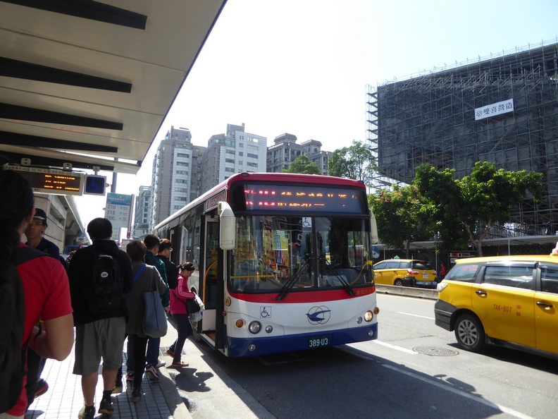
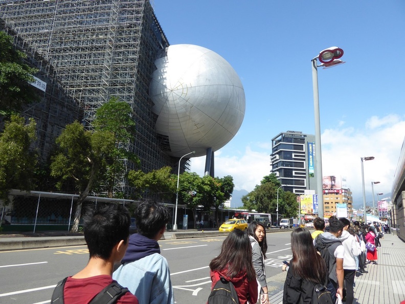
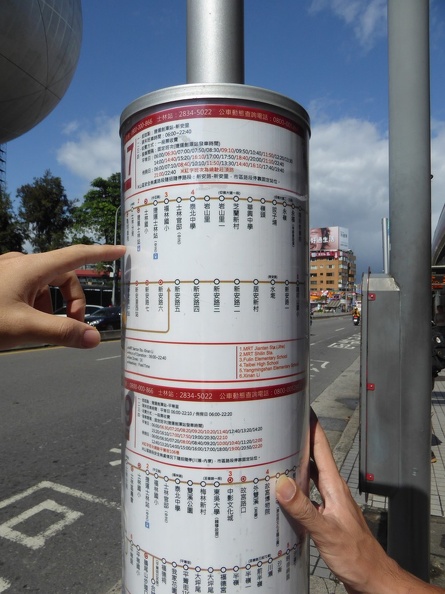
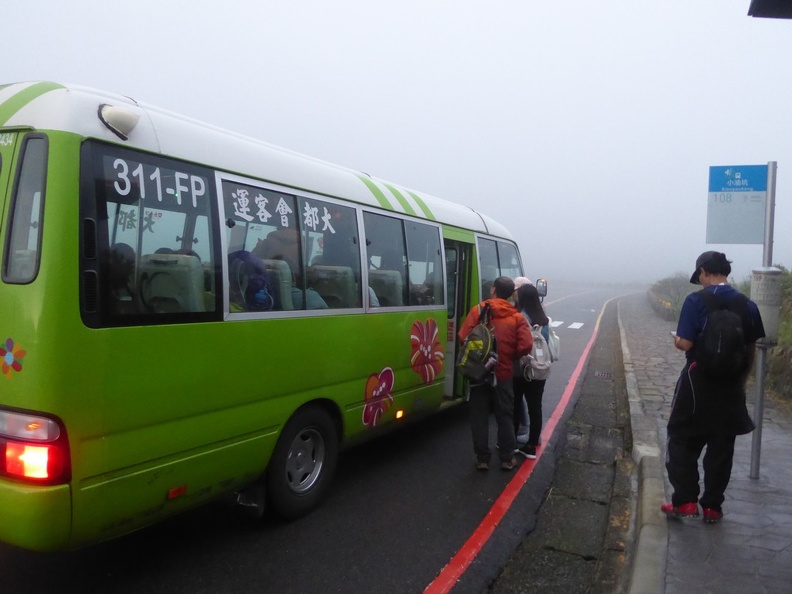
Alternatively, from Jiantan MRT Station, you have a wider choice of large and small buses headed up to the mountain. These buses all depart from Jiantan (劍潭) MRT station near Taipei Shilin Night Market. It is located just beside the MRT station’s at “Exit 1” to get directly to the bus stops above ground. A larger city bus, such as service 230 serves a small nuclear town at the base of the mountain in the Shilin District with it’s own bus terminal. It is a short walk from the bus terminal station to the cultivated area of the park.
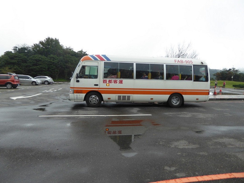
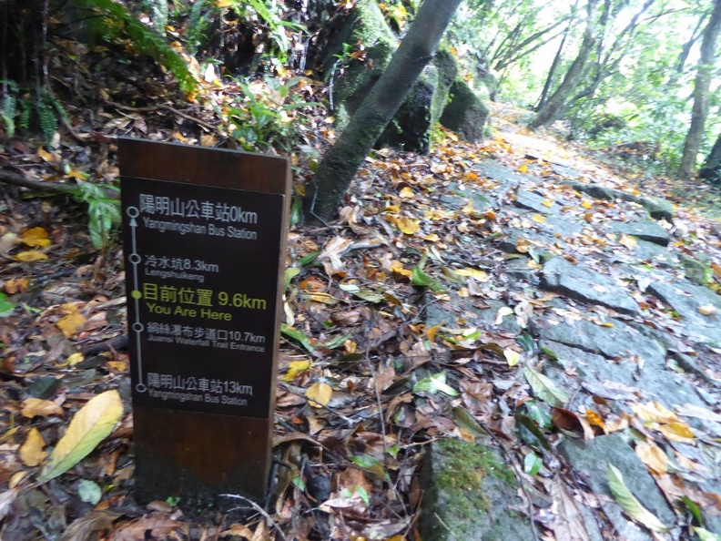
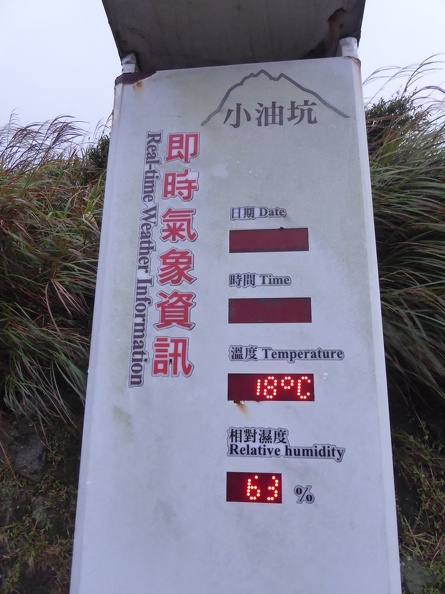
Departing from Jiantan is recommended as there a number of smaller mini-buses serving the inner parts of the National park, something the bigger buses won’t do. Selections here includes mini-bus S15 or S17 departing hourly from Beitou for Judz-hu and Yang Ming Shan station (陽明山). Furthermore, the hour-long bus ride from Jiantan brings you through past nature sights. This includes Xiaoyoukeng (小油坑), Lengshuikeng (冷水坑), and Qingtiangang Grassland Trails (擎天崗). A one-way fare is NT$15, payable by cash or Easycard.
Towns along Yangde Boulevard
The bus ride up Yang Ming Shan Mountain passes through a number of small self-sufficient nuclear town. One such town is along Yangde Boulevard, which branches off to Gezhi Road in Jiantan. There are several amenities here and also serves as a base to explore the mountain. Moreover, the area has a few shops like a school, 7/11, fast food restaurants (Macdonalds) and even a Starbucks.
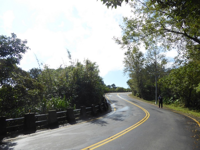
Leaving the village uphill along up Jinshan Road, you carry on a winding two lane dual carriageway mountain road (Lane 101 Jing Shan Road). This brings you past several scenic trials which also lead up the nature park visitor center. This route is popular with cyclists who often ply the winding roads here in long bicycle convoys.
Mountain Trails up
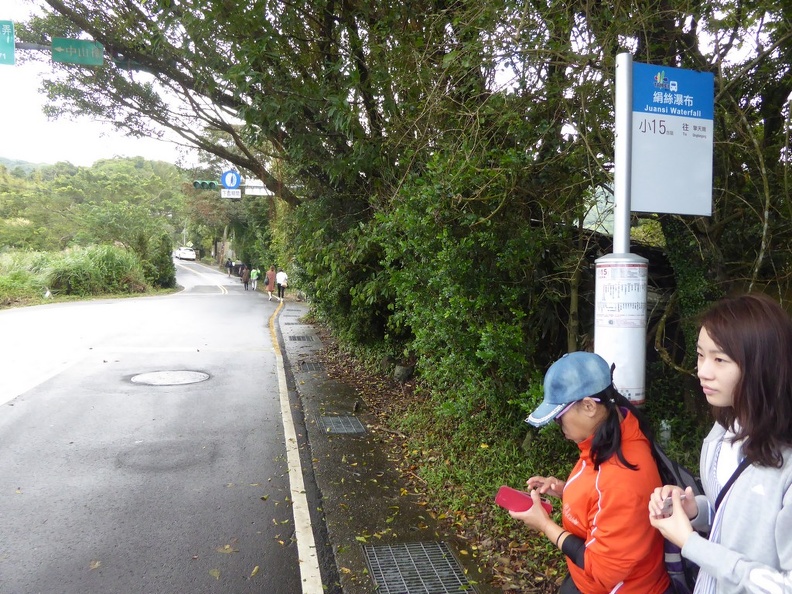
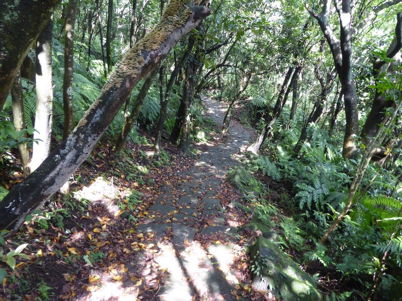
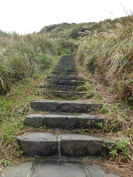
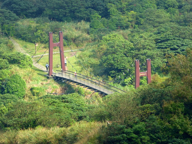
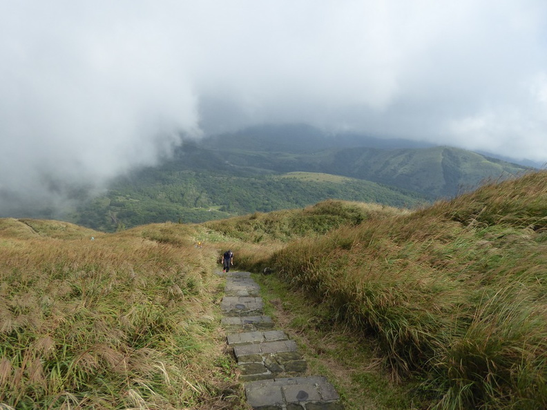
Alternatively, you can hop off the bus and do the final 5km up the hill through trials. There are several sheltered trials running through the forests up the mountain. You pass by some water features, as well as Waterfall trails, bridges and broad walks along the way. As you near the base visitor center, the trail ascend becomes less-pronounced where it flattens to a large plateau clearing. Here you can see the Qing Tian gang Grassland Trails as well as the Suspension bridge in the plains.
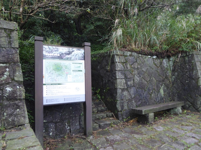
Furthermore, the Tianmu Trail (天母古道) is one of Taipei’s most popular day hiking destinations. It starts at the end of the Zhongshan North Road (Sec. 7). From here, you can find the entrance is marked with a large signboard and map (in English). Up the trail about 1000 step stairway, you can see a historic water pipe line along the trail, built in 1940s.
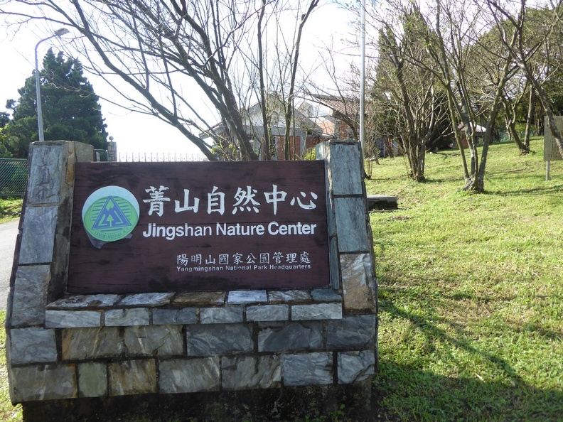
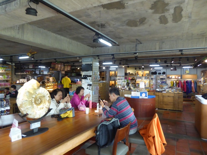
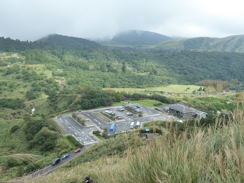
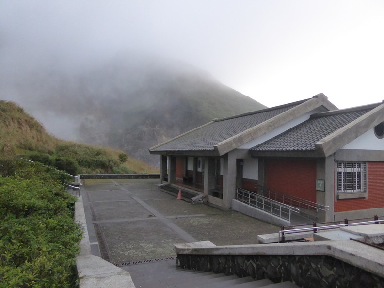
Leng Shui Keng Visitor center
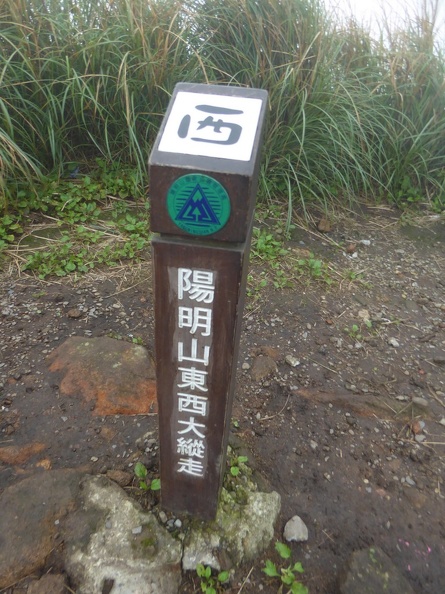
Leng Shui Keng is a region in the Yang Ming Shan national park and the focal start point of my journey. In a nutshell, Yang Ming Shan (阳明山 in simplified Chinese) is one of Taiwan’s eight national parks. Yang Ming Shan’s original name was Cao shan, meaning grass mountain in Mandarin. This old name took reference from the tall silver grass that blankets the mountain’s highest slopes. Chiang Kai-shek renamed it to the current Mount Yang Ming after his favorite Ming philosopher Wang Yang-ming, who lived from A.D. 1472-1529.
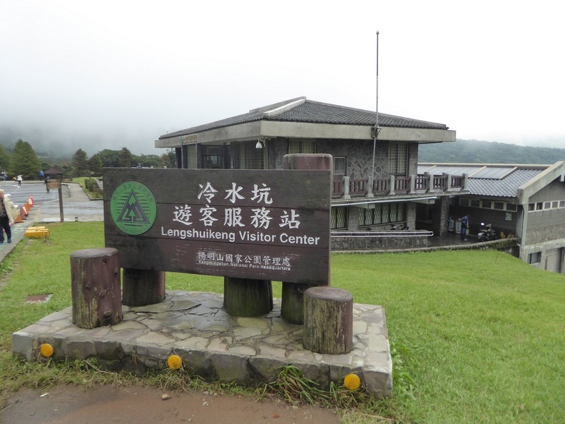
The visitor center provides service and basic amenities. This includes public toilets, washing and changing areas, as well as hot and cold water dispensers to replenish your supplies. Additionally, a restaurant café, nature park gift shop and a hot spring reside here too.
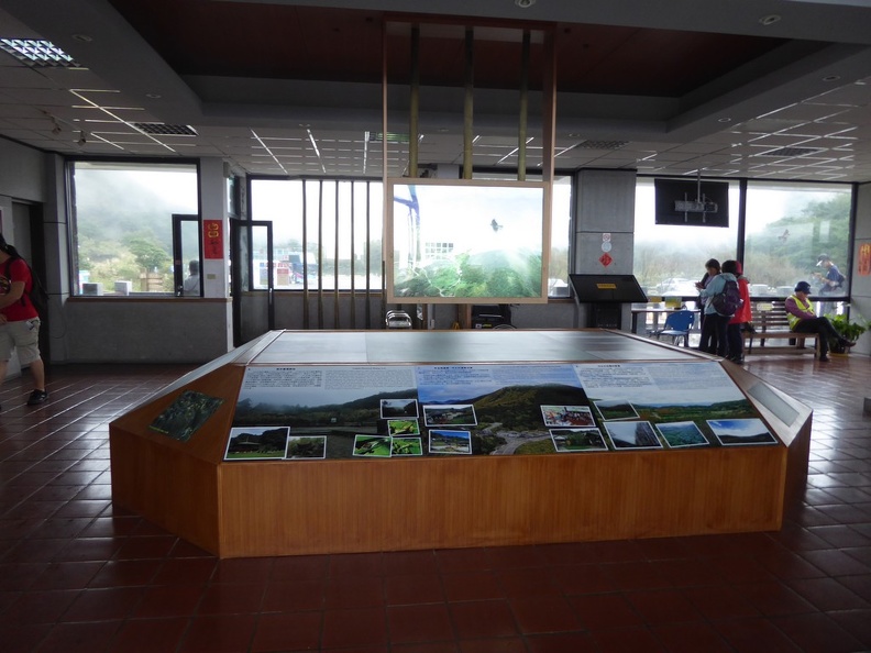
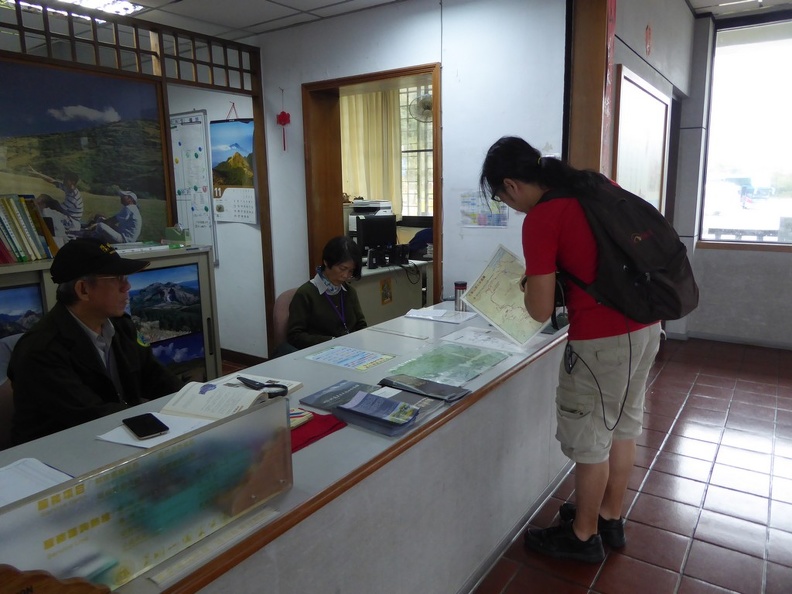
The top floors houses a reception and park information counter, as well as a nature park information gallery. It teaches of the Geology of the Pleistocene rock in the region, as well as the landscape surrounding the dormant volcano with the last recorded eruption being on 700,000 BC. There is no fee to enter the National Park, though it is recommended to visit in the day.

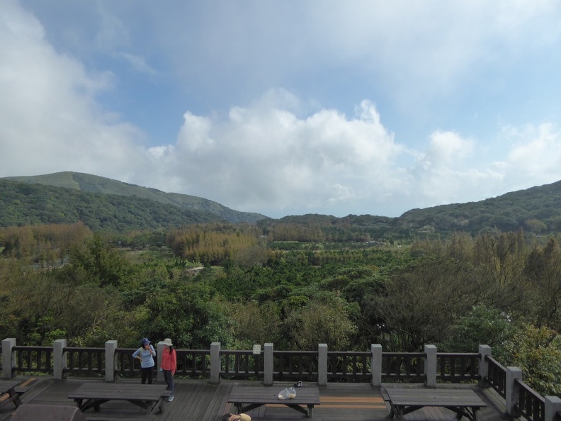
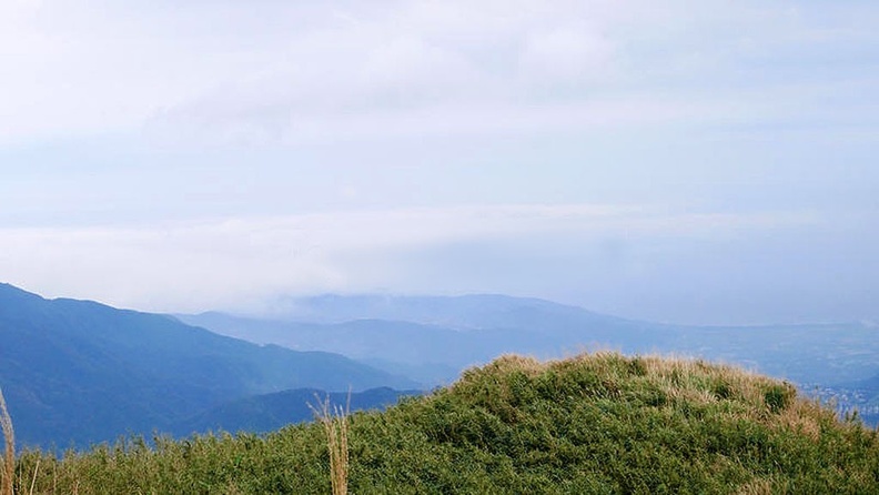
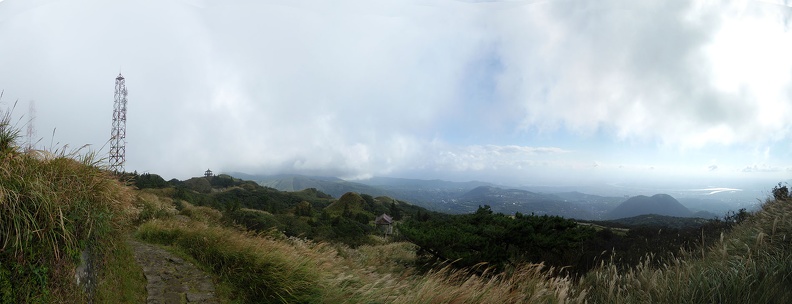
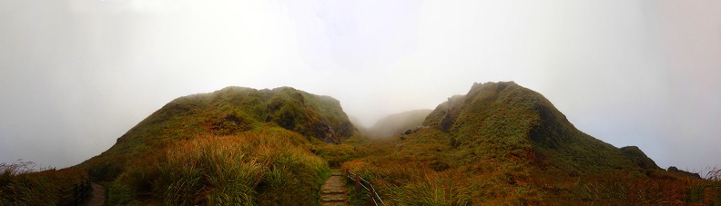
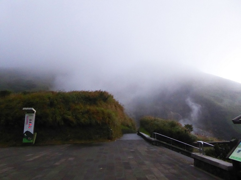
The air up here is clean and refreshing. The visitor center itself sits about 301 meters above sea level. At times, clouds can be seen crossing over the horizon up here past the scenic in the Qing tian gang Grassland area. You can check the view of this vast grass land flanked by rolling hills over the horizon from the viewing balcony of the visitor center.
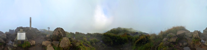
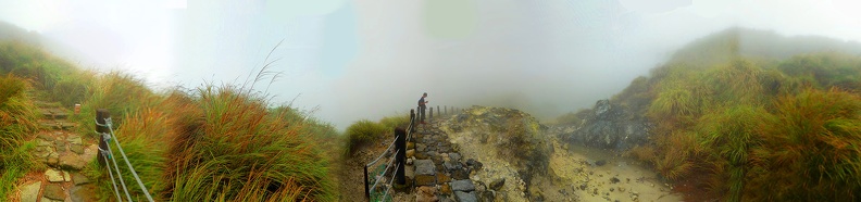
Panorama of Leng Shui Keng, Qing Tian Gang Grassland Trails
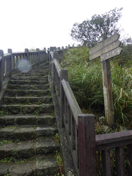
It is from there where you can start your climb up Mount Qixing. A climbing mountain trial starts off just in front of the visitor center, marked the Qixing Shan trial. It is an upward northbound stair climb and the start of the upper trek towards Mt Qixing.
My journey begins departing from the southern visitor center at Leng Shui Keng headed north-west through the two Mt Qixing peaks and ending at the Xiao You Keng Western Visitor center near Lengshuikeng. Leng Shui Keng is a volcanic hot spring area. Such a trek will take an approximately 3-4 hours at your own leisurely pace, taking photos and enjoying the views along the way. If you were to do a speed climb, you could easily complete it in under 2 hours.
Heading up Mount Qixing
Our mountain of interest, Qixing Mountain, also spelled Qi Xing Shan (七星山 in Mandarin) or Chihsing Mountain. Mt. Qixing is also the highest (and dormant) volcano in the administrative area of Taipei City.
The “Seven Star Mountain”
Moreover, the mountain is also known as Cising, or the “Seven Star Mountain“. The mountain erupted about 700,000 years ago, creating a crater edge which eventually collapsed in from erosion. The end result is the seven small peaks at the crater which gives it the “Seven star” name.
Moreover, this mountain is the source of the name for Shi chi sei District (七星郡), Taihoku Prefecture, Taiwan under Japanese rule. This district today includes the modern day Xizhi, Shilin, Beitou, Nangang, Neihu, Songshan, and Xinyi.
Geographically, the volcano sits heart and center of Yang Ming Shan National Park itself. It is situated at the rim of Taipei Basin, and it is part of the Taiwanese Datun Volcano Group. The mountain comprises of two peaks, with its highest and main peak at an elevation of about 1,120 meters above sea level.
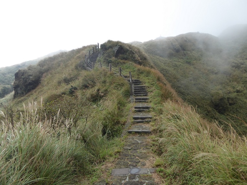
On the initial climb up, the step climb up comprises of a series of mild to moderate incline climbs. Up here, there are several open rest spots and spaces for you to stop for a rest or take photos of the beauty around. The view up here gets better with every step up.
Qing Tian Gang Grassland
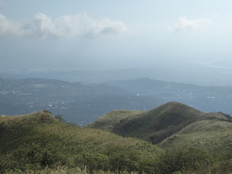
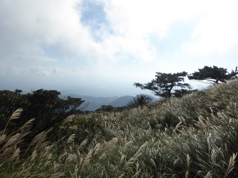
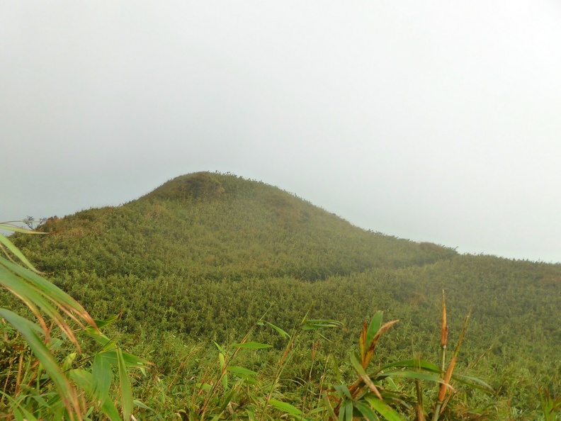
At the top of this first hill, you get treated to a full view of the Qing Tian Gang Grassland. This is before moving northwards inland further into the mountains along the ridgeline. From here, we can also see the suspension bridge in the distance. The view overlooking the Qing Tian Gang plains gets better with each step you climb.
Furthermore, the area up here is rather windy. Occasionally, you have to wait for the clouds to pass up here. Even in autumn, the temperatures up here seldom go below 15 degrees Celsius, so you can easily comfortably climb the mountain even in a T-Shirt. A jacket may be useful against the strong winds up here. But I never had a need for it.
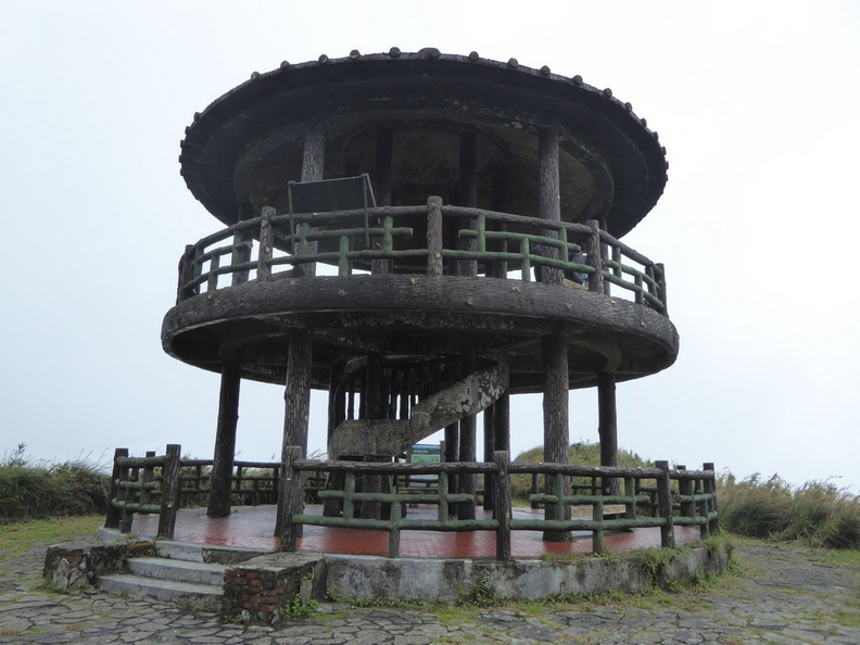
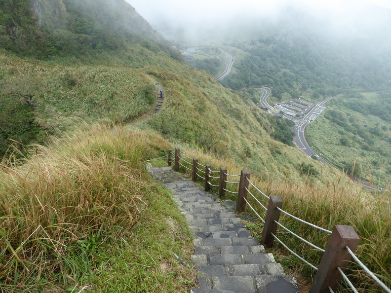
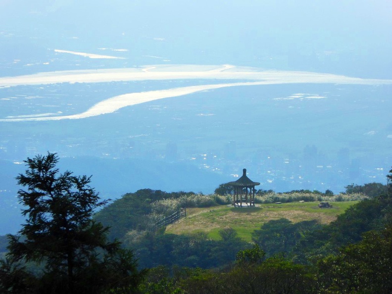
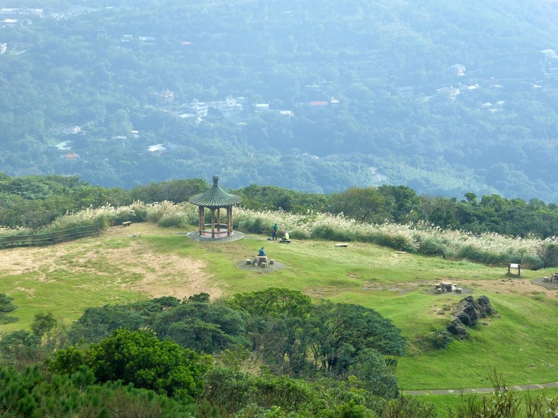
The mountains are connected from the lower elevation towns by well-maintained roads and hiking trails. Hence, no bashing through unkept vegetation or dealing with uneven roads. A small pagoda-like watch tower lookout point is located up here. It sits up here at the top of the hill near the Meng Huan Hu pond. It overlooks Cixing (Qixing) park and adjacent to the twin peaks of Qixing Mountain.
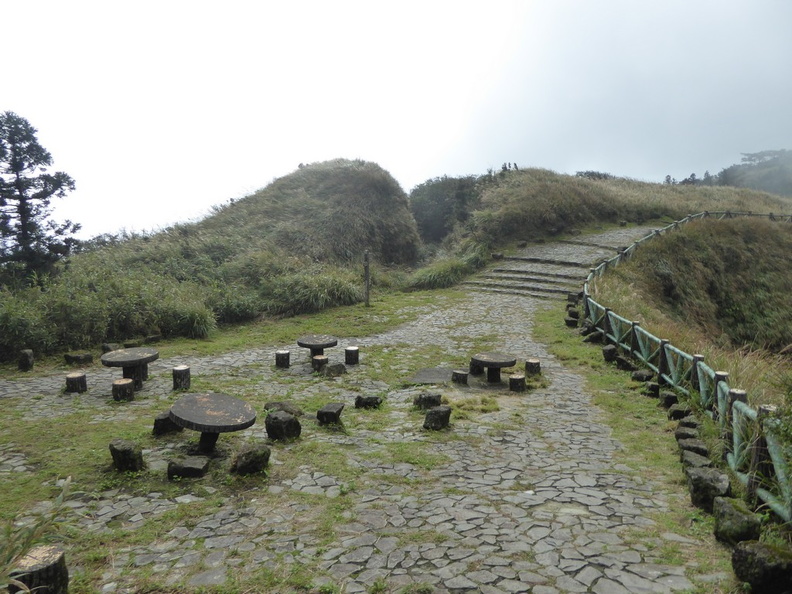
Cising Park
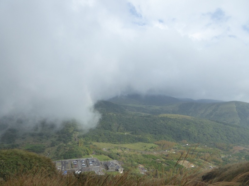
Past the overlook point is Qixing Park. The park is located on a flat open clearing located south of the mountain’s eastern summit. The park is home to four different pavilions, including a couple of stone tables and chairs laid all about the park, like a Zen garden. It is a popular rest stop for people climbing Mt. Qixing.
The views are here are majestic, despite it not even being at the mountain peak yet. There is scenery beauty all around you. Noticeably, the lush green mountains in front of your and the darker ones faded into the background into the horizon. The view is accentuated and contrasted by thick heavy clouds separated by the said horizon.

Trails here lead from Cising Park to Menghuan Lake then Lengshuikeng. Notably, Lengshuikeng is the location of a local volcanic hot spring located further north from here. Moreover, it complements the myriad of natural features in the volcanic active region which I will touch on later.
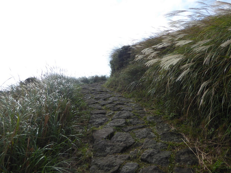
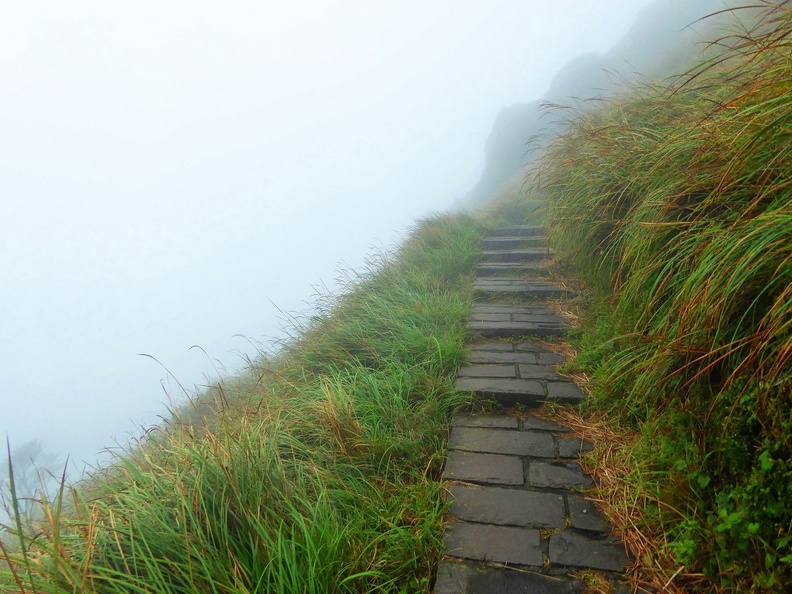
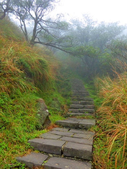
The pathway up here was built in 1940s. It is popular with trekking locals, who come up here for their regular trek or cross-country runs and to enjoy the clear mountain air. Hence, it is not uncommon to see retirees dressed in trekking gear armed with trekking sticks doing their rounds up the mountain paths. Be expected to be passed by the quick-footed veteran locals who make the trip up here almost every week. Notably, this trail is known to be one of Taipei’s most popular day hiking destinations today.
Silvergrass plains
Moreover, the paths are well maintained comprising of a combination of gravel pathways and laid steps at areas of steeper elevation. Up here, you can see the tall silvergrass which gave Yangmingshan’s it’s original name- Caoshan. Caoshan is directly translated into “Grass Mountain” in Mandarin.
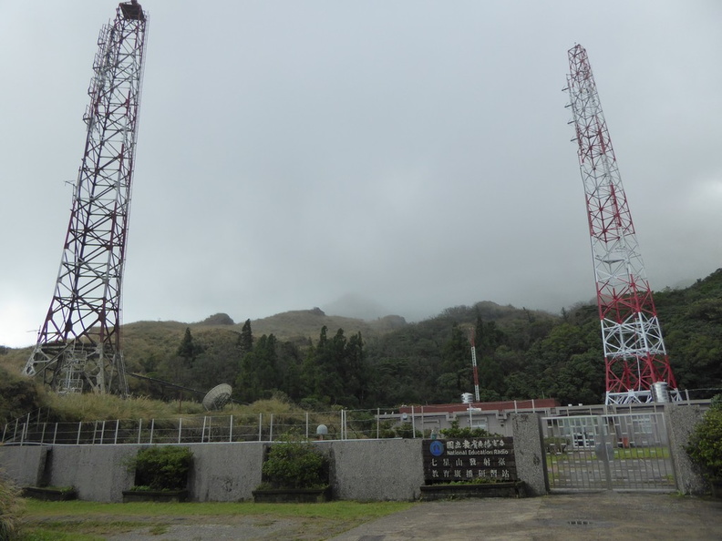
From the lookout point, you pass a radio tower station with twin antenna. The pathway road splits into two, one headed up the summit and the other towards Cising Park. The paths here are well maintained and very clearly marked, so it is almost impossible to get lost here.

Journey to the peaks
Heading up the mountain, you will be treated with views of the horizon and Cising park in the far distance. It gets rather cloudy up here at times, with the passing clouds leaving the place rather damp at times, but otherwise not too chilly at all.
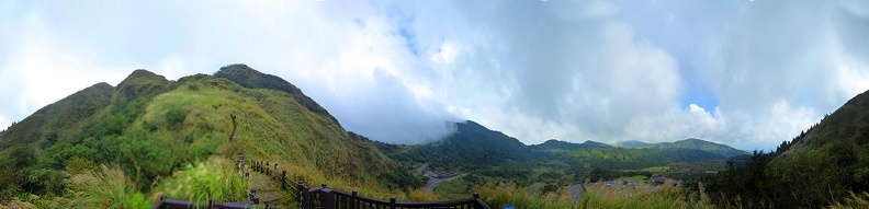
Panorama of Qing Tian Gang
Moreover, the climbing incline does get steeper with each passing step up. The park is distinctively characterized by subtropical rain forest at an elevation below 1000 meters. This is similar to the tropical secondary forests in Singapore. Above a 1000 meter elevation, we start to see more short, scrub-like trees and tall grasses as the main form of natural vegetation up here.
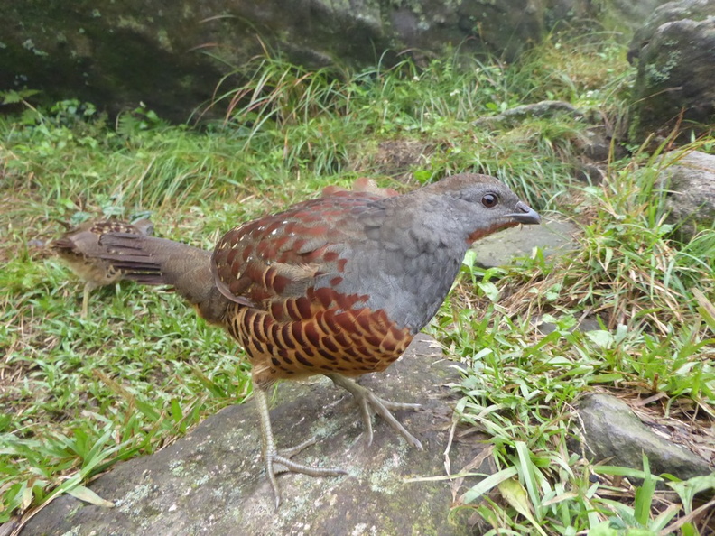
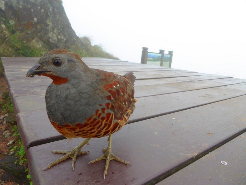
Additionally, the vegetation up here is still evergreen all year round. There are also a couple of flightless jungle fowls who call the mountain their home. At times you can see them hanging around the summit area pecking on any food leftovers by the climbers. They could be probably living off climbers as they don’t seem too startled by the presence of people either.
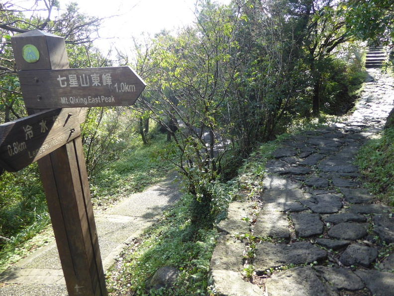
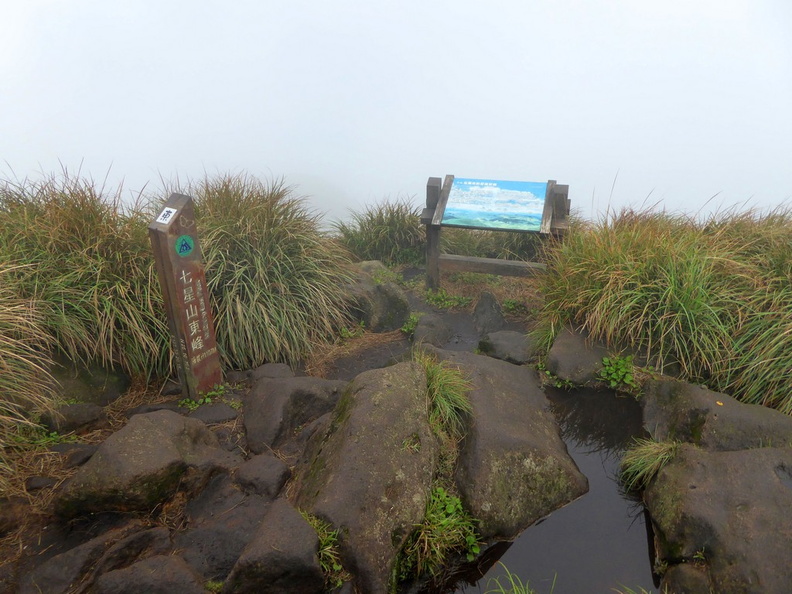
Midway along the climb to the summit, you’ll find yourself at a trail split. Each route leads respectively to each of the mountain’s either two summits. The main and east peaks are just a mere 300 meters apart and you can easily cover both.
The steps and incline does get a lot steeper as you near the top. Moreover, the path can get rather slippery if wet. Hence, summiting the top can be fairly treacherous during periods of rain. At times, the top here is often shrouded by passing clouds which makes the area particularly damp. Thus, this can obscure your views and mask any potential hazards and the view around you.
Summiting the twin peaks
Mount Qixing is a majestic mountain by itself and very easy to recognize. The mountain has two peaks, each only about 300 meters apart. The main and east peaks are shaped like a tall, narrow column-like structure. Moreover, it is made of angular boulders with a flat top clearing. The shape of both the main and subordinate peaks are widely known to by the locals here to physically look like the Chinese character for “mountain” (Shan 山).
Hence, given the close proximity of the two peaks, it is not uncommon for climbers to summit both peaks in rapid succession with the half hour of touching either peak.
At the top
The summit area comprises of a few rocks and boulders at the top. It is flanked by a large clearing with a wooden broadwalk. Furthermore, this clearing is good for groups too, where you can find a place to rest, put your equipment down and have a break.
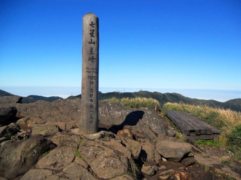
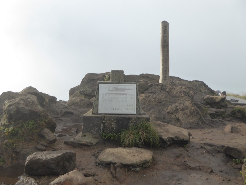
Additionally, up here, you can find the official summit marker. It is a large stone tablet as well as a couple of information signs board describing the scenery landmarks from this vantage point. The tallest main peak of the Seven Star Mountain has an elevation of 1120 meters. Check out the views!

Moreover, the height is reaffirmed by an official height marker which sits in front of a wooden stake. Additionally, this peak is the highest point in Taipei City.
360 Panorama of Mount Qixing in passing cloud
Moreover, given the lack of shelter on the summit, it does get pretty windy up here. So be sure to have your items securely fastened or you may risk them being blown off the mountain top. Also, the winds up here also tend to at times make cloud cover here a nuisance, at times obstructing the fantastic views.

Up here, you can make up the view of the prominence of the Beitou District within Taipei, Taiwan.
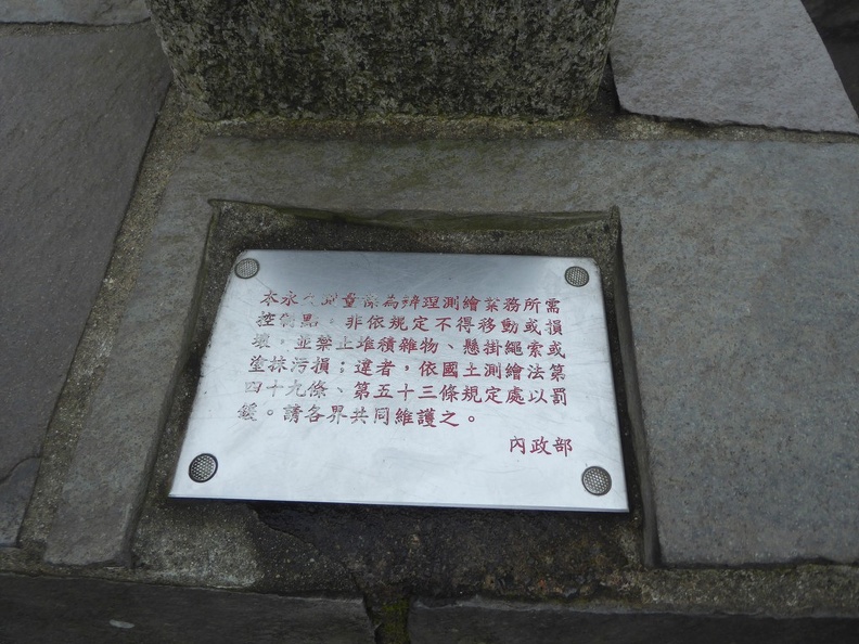
Furthermore, up here, an informative signboard sits at the top of the clearing here as well as a few official National park markers denoting it as an official location. Down from the summit not too far off are several information boards littered around with details of the surrounding Volcanic features which follows.
Volcanic features
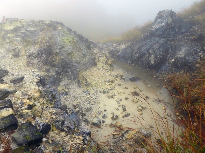
In addition to fantastic views, Mt Qixing is an active volcanic area covered by andesite rock. Its surrounding teaming full of volcanic elements and geothermal activity. Notably, the grounds are rich in sulphur, which can be seen emanating at various points of the ground. This also gives this part of the trail a rather distinctive “rotten egg” smell.
Also, the trails leading throughout the entire park consist of a combination of stone and basalt steps paved steps, as well as gravel paths. The incline can get rather steep in places, with the decent being more hazardous than ascending.
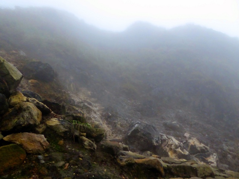
The mountain has faults running across the southeast and northwest contours of the island. Hence, this gave rise to localized volcanic land forms such as hot springs and sulphur deposits. Following on my Qixing journey West bound follows a mountain decent into Xiao You Keng via a mountain valley passageway.
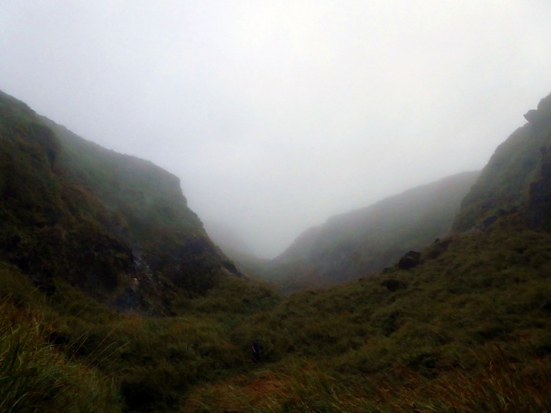
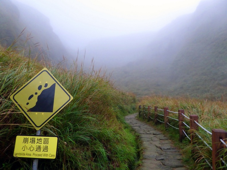
Noticeably, the valley area here is also a land slide hazard area and the volcanic active area is known to produce micro quakes which at times could send rocks rolling down the hills.
Here, it is not uncommon to pass by large sulphur pits, with the distinctive “rotten egg” sulphuric smell emanating from the ground. Also, the terrain here are all caked with white with said dried sulphur crystal deposits. Notably, some of these pits here are massive, some are even large enough to fit an entire car in.
Moreover, some of the pits were also seen smoking with steam. These areas are relatively warmer than the surroundings given the geothermal activity beneath, good to warm down during a winter trek!
Panorama of QIxing Shan Western Trail Sulphur Pits
Moreover, the area is themeing with fumaroles. These fumaroles are a sulphur gas exhaust hole commonly used for the heating of geothermal-heated hot spring waters. These holes ocassionally releases heated water as steam and can be spotted at various spots around Yangmingshan including the Xiao you keng hot springs.
Geothermal features and water
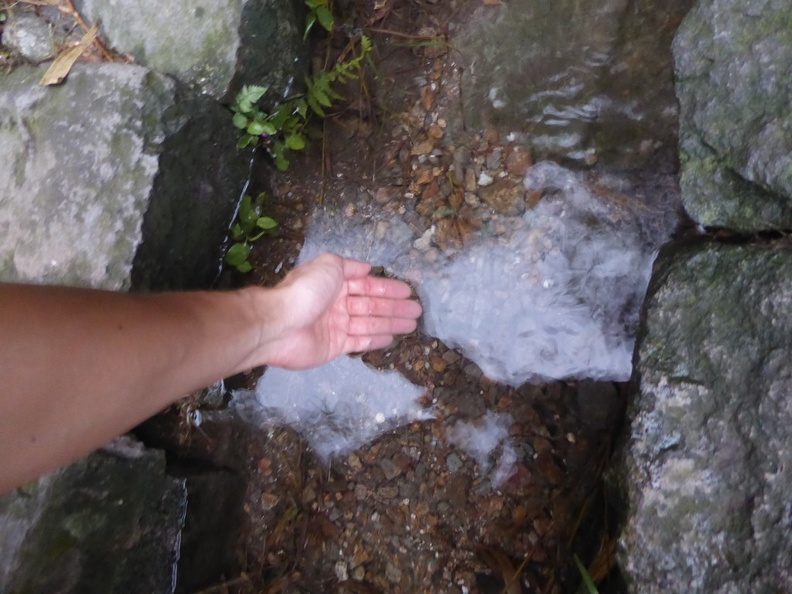
As you near the bottom of the post-volcanic geological park, you reach Xiaoyoukeng. Located on Mt. Qixing’s northwestern corner, it is approximately 805 meters above sea level. From here on your trek, you can chance upon small warm springs running alongside and sometimes through the pathways. They are warm to the touch.
Moreover, this spot is located close by to Mt. Zhuzi, Mt. Datun, and Mt. Xiaoguanyin. It provides views of the northeast coast outside Jinshan town area.
Additionally, some interesting landforms include both cone and strata volcanoes, volcanic craters, crater lakes, waterfalls, springs, and fumaroles.
Shamao Mountain is a round volcanic dome which resembles the shape of a black gauze cap. Its distinctive tholoid shape, otherwise known as a cumulo-dome volcano was formed as the lava was more viscous when the mountain was formed.
Walk through volcanic active area
The Shamao mountain sits 643 meters above sea level, while the Qi gu shan (七股山 in mandarin) sits at 890 meters in height. Both are parasitic volcanoes, formed when the main volcano, Qi xing shan erupted.
In addition to volcanic activity, moreover, the National park used to be a site of prevalent mining operations. However, today, all mining operations had been shut down due to the harm it brings to the environmental and the park’s status as a national park. Today, you can visit the various decommissioned mines littered around the park. One such mine is Liuhuanggu (硫磺谷).
A bus ride back downhill brings you to Leng Shui Keng where you can connect back where you came from to the Taipei Shilin area. Moreover, this night market will be a good way to conclude your busy day on the mountain as well as tuck in with Taiwanese gastronomical delicacies.
In conclusion, Yang Ming Shan is one of the few natural scenic sights which you can easily visit on a day trip from Taipei. The mountains are connected by well maintained hiking trails which you can explore without a car. It’s possible to do a day hike just by foot and getting there by public buses. There is more than enough to see and do for an entire day.
View more photos of Yang Ming Shan in a separate gallery here.
Thankyou for the very good description!!! Really enjoyed reading it.
The wooden stake/pole near the stone summit marker: how high/tall is that wooden pole with the writing on it in mandarin?
Best Regards, Danny